Vendlincourt geodata
Vendlincourt (Jura) is a populated place; located in Switzerland in Europe/Zurich (GMT+2) time zone. With population of 578 people, there are 1717 cities with bigger population in this country. Compared to other cities in Switzerland, 82.9% of cities are located further ↓South; 83.4% of cities are located further →East and 66.3% of cities have higher elevation than Vendlincourt. Note1


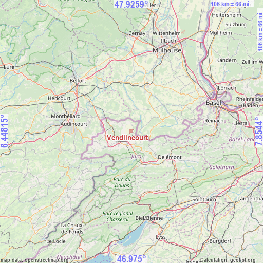
Vendlincourt GPS coordinates[2]
47° 27' 9.36" North, 7° 9' 4.608" East
| Map corner | latitude | longitude |
|---|---|---|
| Upper-left | 47.9259°, | 6.44815° |
| Center: | 47.4526°, | 7.15128° |
| Lower-right: | 46.975°, | 7.8544° |
| Map W x H: | 105.7×105.7 km | = 65.7×65.7mi |
| max Lat: | 47.76737° ⇑17.1% North |
| Vendlincourt: | 47.4526° |
| min Lat: | ⇓82.9% South 45.83203° |
| min Long | Vendlincourt | max Long |
| 5.97153° | 7.15128° | 10.44624° |
| W 16.6%⇐ | ⇒83.4% E |
Elevation
Elevation of Vendlincourt is 444 m = 1457 ft, and this is 114.2 m = 375 ft below average elevation for this country.
| Max E: |
1845 m = 6053 ft | 66.3% |
| Avg. | 558.2 m = 1831 ft | |
| Vendlincourt | 444 m = 1457 ft | |
Min E: |
197 m = 646 ft | 33.7% |
See also: Switzerland elevation on elevation.city.
Geographical zone
Vendlincourt is located in North temperate zone (between Tropic of Cancer and the Arctic Circle). Distance of this North polar circle is 2124.9 km =1320.4 mi to North.| Distance of | km | miles | from Vendlincourt |
|---|---|---|---|
| North Pole | 4730.8 | 2939.6 | to North |
| Arctic Circle | 2124.9 | 1320.4 | to North |
| Tropic Cancer | 2670.3 | 1659.2 | to South |
| Equator | 5276.2 | 3278.5 | to South |


Nearby cities:
15 places around Vendlincourt: (largest is in red/bold)
• Alle
3.4 km =2.1 mi,  207°
207°
• Bassecourt
14.5 km =9 mi,  151°
151°
• Boncourt
11.4 km =7.1 mi,  294°
294°
• Bonfol
2.8 km =1.7 mi,  1°
1°
• Chevenez
13.1 km =8.1 mi,  239°
239°
• Coeuve
3.9 km =2.4 mi,  269°
269°
• Cornol
5.1 km =3.2 mi,  170°
170°
• Courfaivre
16.4 km =10.2 mi,  143°
143°
• Courgenay
5.7 km =3.5 mi,  200°
200°
• Courtedoux
9.7 km =6 mi, 239°
• Courtemaîche
7.8 km =4.8 mi, 273°
• Fontenais
7.6 km =4.7 mi,  223°
223°
• Glovelier
13.7 km =8.5 mi,  162°
162°
• Porrentruy
6.9 km =4.3 mi, 235°
• Saint-Ursanne
9.8 km =6.1 mi,  178°
178°
Sources, notices
• [Note1] Compared only with cities in Switzerland existing in our database
• [Src1] Map data: © OpenStreetMap contributors (CC-BY-SA)
• [Src2] Other city data from geonames.org with taken over terms of usage.
• [Src3] Geographical zone / Annual Mean Temperature by Robert A. Rohde @ Wikipedia
