Courgenay geodata
Courgenay (Jura) is a populated place; located in Switzerland in Europe/Zurich (GMT+2) time zone. With population of 2,106 people, there are 805 cities with bigger population in this country. Compared to other cities in Switzerland, 74.7% of cities are located further ↓South; 84.2% of cities are located further →East and 53.5% of cities have lower elevation than Courgenay. Note1


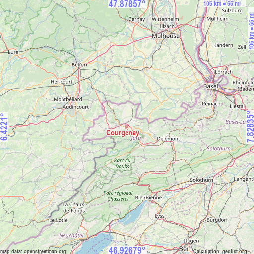
Courgenay GPS coordinates[2]
47° 24' 17.388" North, 7° 7' 30.792" East
| Map corner | latitude | longitude |
|---|---|---|
| Upper-left | 47.87857°, | 6.4221° |
| Center: | 47.40483°, | 7.12522° |
| Lower-right: | 46.92679°, | 7.82835° |
| Map W x H: | 105.8×105.8 km | = 65.7×65.7mi |
| max Lat: | 47.76737° ⇑25.3% North |
| Courgenay: | 47.40483° |
| min Lat: | ⇓74.7% South 45.83203° |
| min Long | Courgenay | max Long |
| 5.97153° | 7.12522° | 10.44624° |
| W 15.8%⇐ | ⇒84.2% E |
Elevation
Elevation of Courgenay is 489 m = 1604 ft, and this is 69.2 m = 227 ft below average elevation for this country.
| Max E: |
1845 m = 6053 ft | 46.5% |
| Avg. | 558.2 m = 1831 ft | |
| Courgenay | 489 m = 1604 ft | |
Min E: |
197 m = 646 ft | 53.5% |
See also: Switzerland elevation on elevation.city.
Geographical zone
Courgenay is located in North temperate zone (between Tropic of Cancer and the Arctic Circle). Distance of this North polar circle is 2130.3 km =1323.7 mi to North.| Distance of | km | miles | from Courgenay |
|---|---|---|---|
| North Pole | 4736.1 | 2942.9 | to North |
| Arctic Circle | 2130.3 | 1323.7 | to North |
| Tropic Cancer | 2665 | 1656 | to South |
| Equator | 5270.9 | 3275.2 | to South |


Nearby cities:
15 places around Courgenay: (largest is in red/bold)
• Alle
2.3 km =1.4 mi,  9°
9°
• Bassecourt
11.6 km =7.2 mi,  129°
129°
• Boncourt
13.1 km =8.1 mi,  319°
319°
• Bonfol
8.3 km =5.2 mi, 14°
• Chevenez
9.5 km =5.9 mi,  262°
262°
• Coeuve
5.6 km =3.5 mi,  340°
340°
• Cornol
2.8 km =1.7 mi,  83°
83°
• Courtedoux
6.4 km =4 mi,  273°
273°
• Courtemaîche
8.2 km =5.1 mi, 315°
• Fontenais
3.3 km =2.1 mi, 266°
• Glovelier
9.8 km =6.1 mi,  141°
141°
• Lajoux
14 km =8.7 mi,  176°
176°
• Porrentruy
4 km =2.5 mi,  290°
290°
• Saint-Ursanne
5 km =3.1 mi,  153°
153°
• Vendlincourt
5.7 km =3.5 mi,  20°
20°
Sources, notices
• [Note1] Compared only with cities in Switzerland existing in our database
• [Src1] Map data: © OpenStreetMap contributors (CC-BY-SA)
• [Src2] Other city data from geonames.org with taken over terms of usage.
• [Src3] Geographical zone / Annual Mean Temperature by Robert A. Rohde @ Wikipedia
