Sirnach geodata
Sirnach (Thurgau) is a populated place; located in Switzerland in Europe/Zurich (GMT+2) time zone. With population of 6,463 people, there are 258 cities with bigger population in this country. Compared to other cities in Switzerland, 84% of cities are located further ↓South; 88.2% of cities are located further ←West and 64% of cities have lower elevation than Sirnach. Note1


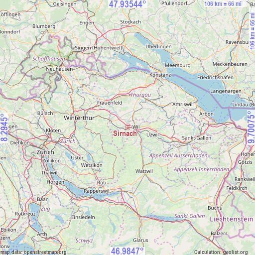
Sirnach GPS coordinates[2]
47° 27' 43.992" North, 8° 59' 51.468" East
| Map corner | latitude | longitude |
|---|---|---|
| Upper-left | 47.93544°, | 8.2945° |
| Center: | 47.46222°, | 8.99763° |
| Lower-right: | 46.9847°, | 9.70075° |
| Map W x H: | 105.7×105.7 km | = 65.7×65.7mi |
| max Lat: | 47.76737° ⇑16% North |
| Sirnach: | 47.46222° |
| min Lat: | ⇓84% South 45.83203° |
| min Long | Sirnach | max Long |
| 5.97153° | 8.99763° | 10.44624° |
| W 88.2%⇐ | ⇒11.8% E |
Elevation
Elevation of Sirnach is 541 m = 1775 ft, and this is 17.2 m = 56 ft below average elevation for this country.
| Max E: |
1845 m = 6053 ft | 36% |
| Avg. | 558.2 m = 1831 ft | |
| Sirnach | 541 m = 1775 ft | |
Min E: |
197 m = 646 ft | 64% |
See also: Switzerland elevation on elevation.city.
Geographical zone
Sirnach is located in North temperate zone (between Tropic of Cancer and the Arctic Circle). Distance of this North polar circle is 2123.9 km =1319.7 mi to North.| Distance of | km | miles | from Sirnach |
|---|---|---|---|
| North Pole | 4729.8 | 2939 | to North |
| Arctic Circle | 2123.9 | 1319.7 | to North |
| Tropic Cancer | 2671.4 | 1659.9 | to South |
| Equator | 5277.3 | 3279.2 | to South |


Nearby cities:
15 places around Sirnach: (largest is in red/bold)
• Aadorf
8 km =5 mi,  294°
294°
• Affeltrangen
7.6 km =4.7 mi,  20°
20°
• Bronschhofen
3.3 km =2.1 mi,  57°
57°
• Eschlikon
2.5 km =1.6 mi,  273°
273°
• Fischingen
5.8 km =3.6 mi,  202°
202°
• Jonschwil
7.9 km =4.9 mi,  122°
122°
• Kirchberg
6.5 km =4 mi,  150°
150°
• Lommis
6.1 km =3.8 mi,  359°
359°
• Matzingen
8 km =5 mi,  322°
322°
• Münchwilen
1.7 km =1.1 mi, 357°
• Rickenbach bei Wil
4.2 km =2.6 mi,  111°
111°
• Stettfurt
7.8 km =4.8 mi,  334°
334°
• Wil
3.6 km =2.2 mi,  91°
91°
• Wängi
5.1 km =3.2 mi, 318°
• Zuzwil
8.7 km =5.4 mi,  80°
80°
Sources, notices
• [Note1] Compared only with cities in Switzerland existing in our database
• [Src1] Map data: © OpenStreetMap contributors (CC-BY-SA)
• [Src2] Other city data from geonames.org with taken over terms of usage.
• [Src3] Geographical zone / Annual Mean Temperature by Robert A. Rohde @ Wikipedia
