Eschlikon geodata
Eschlikon (Thurgau) is a populated place; located in Switzerland in Europe/Zurich (GMT+2) time zone. With population of 3,425 people, there are 515 cities with bigger population in this country. Compared to other cities in Switzerland, 84.1% of cities are located further ↓South; 86.6% of cities are located further ←West and 69.7% of cities have lower elevation than Eschlikon. Note1


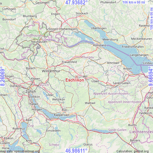
Eschlikon GPS coordinates[2]
47° 27' 48.996" North, 8° 57' 49.716" East
| Map corner | latitude | longitude |
|---|---|---|
| Upper-left | 47.93682°, | 8.26069° |
| Center: | 47.46361°, | 8.96381° |
| Lower-right: | 46.98611°, | 9.66694° |
| Map W x H: | 105.7×105.7 km | = 65.7×65.7mi |
| max Lat: | 47.76737° ⇑15.9% North |
| Eschlikon: | 47.46361° |
| min Lat: | ⇓84.1% South 45.83203° |
| min Long | Eschlikon | max Long |
| 5.97153° | 8.96381° | 10.44624° |
| W 86.6%⇐ | ⇒13.4% E |
Elevation
Elevation of Eschlikon is 571 m = 1873 ft, and this is 12.8 m = 42 ft above average elevation for this country.
| Max E: |
1845 m = 6053 ft | 30.3% |
| Eschlikon | 571 m 1873 ft | |
| Avg. | 558.2 m = 1831 ft | |
Min E: |
197 m = 646 ft | 69.7% |
See also: Switzerland elevation on elevation.city.
Geographical zone
Eschlikon is located in North temperate zone (between Tropic of Cancer and the Arctic Circle). Distance of this North polar circle is 2123.7 km =1319.6 mi to North.| Distance of | km | miles | from Eschlikon |
|---|---|---|---|
| North Pole | 4729.6 | 2938.8 | to North |
| Arctic Circle | 2123.7 | 1319.6 | to North |
| Tropic Cancer | 2671.5 | 1660 | to South |
| Equator | 5277.5 | 3279.3 | to South |


Nearby cities:
15 places around Eschlikon: (largest is in red/bold)
• Aadorf
5.7 km =3.5 mi,  303°
303°
• Bronschhofen
5.6 km =3.5 mi,  72°
72°
• Elgg
8.3 km =5.2 mi, 296°
• Elgg / Städtchen und Umgebung
8 km =5 mi,  293°
293°
• Fischingen
5.5 km =3.4 mi,  176°
176°
• Hagenbuch
8.4 km =5.2 mi,  318°
318°
• Kirchberg
8.2 km =5.1 mi,  135°
135°
• Lommis
6.5 km =4 mi,  22°
22°
• Matzingen
6.6 km =4.1 mi,  339°
339°
• Münchwilen
2.9 km =1.8 mi,  58°
58°
• Rickenbach bei Wil
6.6 km =4.1 mi,  104°
104°
• Sirnach
2.5 km =1.6 mi,  93°
93°
• Stettfurt
7 km =4.3 mi,  353°
353°
• Wil
6.1 km =3.8 mi, 92°
• Wängi
3.7 km =2.3 mi, 347°
Sources, notices
• [Note1] Compared only with cities in Switzerland existing in our database
• [Src1] Map data: © OpenStreetMap contributors (CC-BY-SA)
• [Src2] Other city data from geonames.org with taken over terms of usage.
• [Src3] Geographical zone / Annual Mean Temperature by Robert A. Rohde @ Wikipedia
