Matzingen geodata
Matzingen (Thurgau) is a populated place; located in Switzerland in Europe/Zurich (GMT+2) time zone. With population of 2,399 people, there are 714 cities with bigger population in this country. Compared to other cities in Switzerland, 92.1% of cities are located further ↓South; 85.5% of cities are located further ←West and 65.9% of cities have higher elevation than Matzingen. Note1


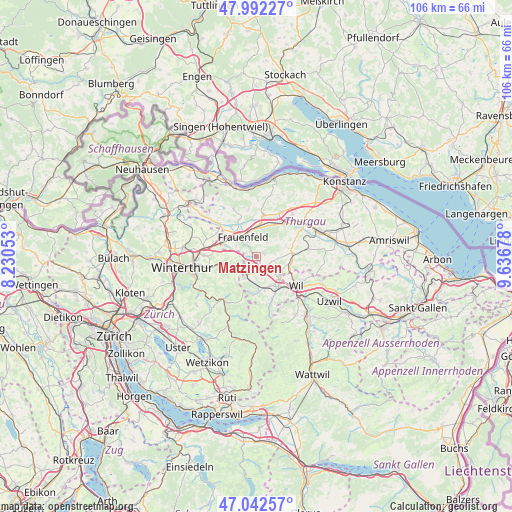
Matzingen GPS coordinates[2]
47° 31' 10.452" North, 8° 56' 1.14" East
| Map corner | latitude | longitude |
|---|---|---|
| Upper-left | 47.99227°, | 8.23053° |
| Center: | 47.51957°, | 8.93365° |
| Lower-right: | 47.04257°, | 9.63678° |
| Map W x H: | 105.6×105.6 km | = 65.6×65.6mi |
| max Lat: | 47.76737° ⇑7.9% North |
| Matzingen: | 47.51957° |
| min Lat: | ⇓92.1% South 45.83203° |
| min Long | Matzingen | max Long |
| 5.97153° | 8.93365° | 10.44624° |
| W 85.5%⇐ | ⇒14.5% E |
Elevation
Elevation of Matzingen is 445 m = 1460 ft, and this is 113.2 m = 371 ft below average elevation for this country.
| Max E: |
1845 m = 6053 ft | 65.9% |
| Avg. | 558.2 m = 1831 ft | |
| Matzingen | 445 m = 1460 ft | |
Min E: |
197 m = 646 ft | 34.1% |
See also: Switzerland elevation on elevation.city.
Geographical zone
Matzingen is located in North temperate zone (between Tropic of Cancer and the Arctic Circle). Distance of this North polar circle is 2117.5 km =1315.8 mi to North.| Distance of | km | miles | from Matzingen |
|---|---|---|---|
| North Pole | 4723.4 | 2935 | to North |
| Arctic Circle | 2117.5 | 1315.8 | to North |
| Tropic Cancer | 2677.8 | 1663.9 | to South |
| Equator | 5283.7 | 3283.1 | to South |


Nearby cities:
15 places around Matzingen: (largest is in red/bold)
• Aadorf
3.9 km =2.4 mi,  218°
218°
• Affeltrangen
7.5 km =4.7 mi,  84°
84°
• Elgg
5.7 km =3.5 mi,  244°
244°
• Elgg / Neu-Elgg
5.6 km =3.5 mi,  249°
249°
• Elgg / Städtchen und Umgebung
5.8 km =3.6 mi, 239°
• Eschlikon
6.6 km =4.1 mi,  159°
159°
• Frauenfeld
5 km =3.1 mi,  328°
328°
• Gachnang
6.4 km =4 mi,  289°
289°
• Hagenbuch
3.3 km =2.1 mi,  271°
271°
• Hüttlingen
7.4 km =4.6 mi,  28°
28°
• Lommis
4.7 km =2.9 mi,  93°
93°
• Münchwilen
6.7 km =4.2 mi,  134°
134°
• Stettfurt
1.6 km =1 mi,  64°
64°
• Thundorf
3.7 km =2.3 mi,  37°
37°
• Wängi
3 km =1.9 mi,  150°
150°
Sources, notices
• [Note1] Compared only with cities in Switzerland existing in our database
• [Src1] Map data: © OpenStreetMap contributors (CC-BY-SA)
• [Src2] Other city data from geonames.org with taken over terms of usage.
• [Src3] Geographical zone / Annual Mean Temperature by Robert A. Rohde @ Wikipedia
