Seuzach / Seuzach (Dorf) geodata
Seuzach / Seuzach (Dorf) (Zurich) is a section of populated place; located in Switzerland in Europe/Zurich (GMT+2) time zone. With population of 1,419 people, there are 1071 cities with bigger population in this country. Compared to other cities in Switzerland, 93.6% of cities are located further ↓South; 77.5% of cities are located further ←West and 62.7% of cities have higher elevation than Seuzach / Seuzach (Dorf). Note1
Current local time in Seuzach / Seuzach (Dorf):
07:37 AM, SaturdayDifference from your time zone: hours


Seuzach / Seuzach (Dorf) GPS coordinates[2]
47° 32' 7.62" North, 8° 44' 14.208" East
| Map corner | latitude | longitude |
|---|---|---|
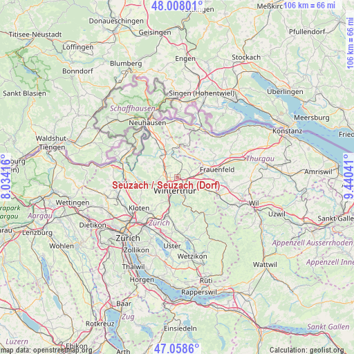
| Upper-left | 48.00801°, | 8.03416° |
| Center: | 47.53545°, | 8.73728° |
| Lower-right: | 47.0586°, | 9.44041° |
| Map W x H: | 105.6×105.6 km | = 65.6×65.6mi |
| max Lat: | 47.76737° ⇑6.4% North |
| Seuzach / Seuzach (Dorf): | 47.53545° |
| min Lat: | ⇓93.6% South 45.83203° |
| min Long | Seuzach / Seuza | max Long |
| 5.97153° | 8.73728° | 10.44624° |
| W 77.5%⇐ | ⇒22.5% E |
Elevation
Elevation of Seuzach / Seuzach (Dorf) is 450 m = 1476 ft, and this is 108.2 m = 355 ft below average elevation for this country.
| Max E: |
1845 m = 6053 ft | 62.7% |
| Avg. | 558.2 m = 1831 ft | |
| Seuzach / Seuzach (Dorf) | 450 m = 1476 ft | |
Min E: |
197 m = 646 ft | 37.3% |
See also: Switzerland elevation on elevation.city.
Geographical zone
Seuzach / Seuzach (Dorf) is located in North temperate zone (between Tropic of Cancer and the Arctic Circle). Distance of this North polar circle is 2115.7 km =1314.6 mi to North.| Distance of | km | miles | from Seuzach / Seuzach (Dorf) |
|---|---|---|---|
| North Pole | 4721.6 | 2933.9 | to North |
| Arctic Circle | 2115.7 | 1314.6 | to North |
| Tropic Cancer | 2679.5 | 1665 | to South |
| Equator | 5285.4 | 3284.2 | to South |


Nearby cities:
15 places around Seuzach / Seuzach (Dorf): (largest is in red/bold)
• Dinhard
3.1 km =1.9 mi,  45°
45°
• Hettlingen
2.7 km =1.7 mi,  296°
296°
• Hettlingen / Dorfkern
2.6 km =1.6 mi, 299°
• Hettlingen / Gübel
2.1 km =1.3 mi,  309°
309°
• Ober-Ohringen
2 km =1.2 mi,  240°
240°
• Oberwinterthur (Kreis 2)
3.1 km =1.9 mi,  131°
131°
• Oberwinterthur (Kreis 2) / Guggenbühl
3 km =1.9 mi,  145°
145°
• Oberwinterthur (Kreis 2) / Zinzikon
2.3 km =1.4 mi,  141°
141°
• Seuzach Dorf
0.4 km =0.2 mi,  272°
272°
• Seuzach Dorf / Brandbüel
0.3 km =0.2 mi,  69°
69°
• Seuzach Dorf / Breite-Weid
0.3 km =0.2 mi,  226°
226°
• Seuzach Dorf / Hochgrüt-Scheidweg
0.8 km =0.5 mi,  221°
221°
• Seuzach Dorf / Pünten-Ifang
0.6 km =0.4 mi,  289°
289°
• Veltheim (Kreis 5)
2.8 km =1.7 mi,  212°
212°
• Veltheim (Kreis 5) / Rosenberg
2.9 km =1.8 mi, 213°
Sources, notices
• [Note1] Compared only with cities in Switzerland existing in our database
• [Src1] Map data: © OpenStreetMap contributors (CC-BY-SA)
• [Src2] Other city data from geonames.org with taken over terms of usage.
• [Src3] Geographical zone / Annual Mean Temperature by Robert A. Rohde @ Wikipedia
