Hettlingen / Gübel geodata
Hettlingen / Gübel (Zurich) is a section of populated place; located in Switzerland in Europe/Zurich (GMT+2) time zone. With population of 664 people, there are 1639 cities with bigger population in this country. Compared to other cities in Switzerland, 94.8% of cities are located further ↓South; 75.5% of cities are located further ←West and 66.3% of cities have higher elevation than Hettlingen / Gübel. Note1


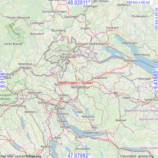
Hettlingen / Gübel GPS coordinates[2]
47° 32' 51.576" North, 8° 42' 56.592" East
| Map corner | latitude | longitude |
|---|---|---|
| Upper-left | 48.02011°, | 8.0126° |
| Center: | 47.54766°, | 8.71572° |
| Lower-right: | 47.07092°, | 9.41885° |
| Map W x H: | 105.5×105.5 km | = 65.6×65.6mi |
| max Lat: | 47.76737° ⇑5.2% North |
| Hettlingen / Gübel: | 47.54766° |
| min Lat: | ⇓94.8% South 45.83203° |
| min Long | Hettlingen / G� | max Long |
| 5.97153° | 8.71572° | 10.44624° |
| W 75.5%⇐ | ⇒24.5% E |
Elevation
Elevation of Hettlingen / Gübel is 444 m = 1457 ft, and this is 114.2 m = 375 ft below average elevation for this country.
| Max E: |
1845 m = 6053 ft | 66.3% |
| Avg. | 558.2 m = 1831 ft | |
| Hettlingen / Gübel | 444 m = 1457 ft | |
Min E: |
197 m = 646 ft | 33.7% |
See also: Switzerland elevation on elevation.city.
Geographical zone
Hettlingen / Gübel is located in North temperate zone (between Tropic of Cancer and the Arctic Circle). Distance of this North polar circle is 2114.4 km =1313.8 mi to North.| Distance of | km | miles | from Hettlingen / Gübel |
|---|---|---|---|
| North Pole | 4720.3 | 2933.1 | to North |
| Arctic Circle | 2114.4 | 1313.8 | to North |
| Tropic Cancer | 2680.9 | 1665.8 | to South |
| Equator | 5286.8 | 3285.1 | to South |


Nearby cities:
15 places around Hettlingen / Gübel: (largest is in red/bold)
• Dinhard
3.9 km =2.4 mi,  77°
77°
• Henggart
3 km =1.9 mi,  303°
303°
• Hettlingen
0.8 km =0.5 mi,  257°
257°
• Hettlingen / Dorfkern
0.7 km =0.4 mi, 263°
• Ober-Ohringen
2.4 km =1.5 mi,  183°
183°
• Oberwinterthur (Kreis 2) / Zinzikon
4.4 km =2.7 mi,  135°
135°
• Seuzach / Seuzach (Dorf)
2.1 km =1.3 mi,  129°
129°
• Seuzach Dorf
1.8 km =1.1 mi, 137°
• Seuzach Dorf / Brandbüel
2.3 km =1.4 mi,  122°
122°
• Seuzach Dorf / Breite-Weid
2.1 km =1.3 mi, 138°
• Seuzach Dorf / Hochgrüt-Scheidweg
2.2 km =1.4 mi,  149°
149°
• Seuzach Dorf / Pünten-Ifang
1.5 km =0.9 mi, 138°
• Veltheim (Kreis 5)
3.7 km =2.3 mi, 178°
• Veltheim (Kreis 5) / Rosenberg
3.8 km =2.4 mi, 179°
• Wülflingen (Kreis 6) / Weinberg
4.2 km =2.6 mi,  195°
195°
Sources, notices
• [Note1] Compared only with cities in Switzerland existing in our database
• [Src1] Map data: © OpenStreetMap contributors (CC-BY-SA)
• [Src2] Other city data from geonames.org with taken over terms of usage.
• [Src3] Geographical zone / Annual Mean Temperature by Robert A. Rohde @ Wikipedia
