Seen (Kreis 3) / Sennhof geodata
Seen (Kreis 3) / Sennhof (Zurich) is a section of populated place; located in Switzerland in Europe/Zurich (GMT+2) time zone. With population of 910 people, there are 1405 cities with bigger population in this country. Compared to other cities in Switzerland, 84.6% of cities are located further ↓South; 78.5% of cities are located further ←West and 50.9% of cities have higher elevation than Seen (Kreis 3) / Sennhof. Note1
Current local time in Seen (Kreis 3) / Sennhof:
07:35 AM, SaturdayDifference from your time zone: hours


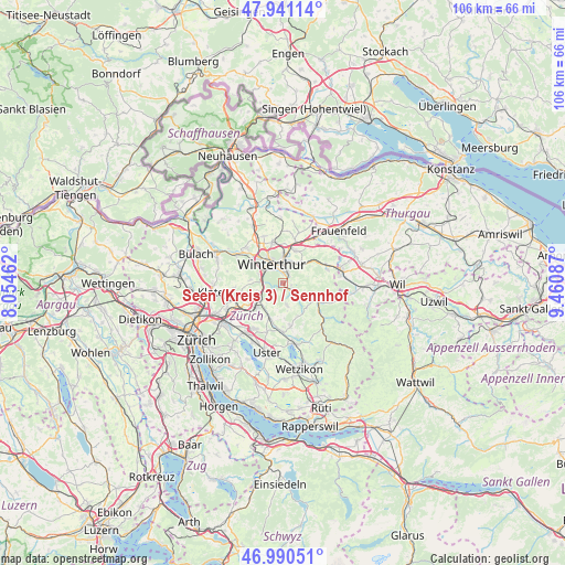
Seen (Kreis 3) / Sennhof GPS coordinates[2]
47° 28' 4.692" North, 8° 45' 27.9" East
| Map corner | latitude | longitude |
|---|---|---|
| Upper-left | 47.94114°, | 8.05462° |
| Center: | 47.46797°, | 8.75775° |
| Lower-right: | 46.99051°, | 9.46087° |
| Map W x H: | 105.7×105.7 km | = 65.7×65.7mi |
| max Lat: | 47.76737° ⇑15.4% North |
| Seen (Kreis 3) / Sennhof: | 47.46797° |
| min Lat: | ⇓84.6% South 45.83203° |
| min Long | Seen (Kreis 3) | max Long |
| 5.97153° | 8.75775° | 10.44624° |
| W 78.5%⇐ | ⇒21.5% E |
Elevation
Elevation of Seen (Kreis 3) / Sennhof is 476 m = 1562 ft, and this is 82.2 m = 270 ft below average elevation for this country.
| Max E: |
1845 m = 6053 ft | 50.9% |
| Avg. | 558.2 m = 1831 ft | |
| Seen (Kreis 3) / Sennhof | 476 m = 1562 ft | |
Min E: |
197 m = 646 ft | 49.1% |
See also: Switzerland elevation on elevation.city.
Geographical zone
Seen (Kreis 3) / Sennhof is located in North temperate zone (between Tropic of Cancer and the Arctic Circle). Distance of this North polar circle is 2123.2 km =1319.3 mi to North.| Distance of | km | miles | from Seen (Kreis 3) / Sennhof |
|---|---|---|---|
| North Pole | 4729.1 | 2938.5 | to North |
| Arctic Circle | 2123.2 | 1319.3 | to North |
| Tropic Cancer | 2672 | 1660.3 | to South |
| Equator | 5277.9 | 3279.5 | to South |


Nearby cities:
15 places around Seen (Kreis 3) / Sennhof: (largest is in red/bold)
• Kollbrunn
2.2 km =1.4 mi,  120°
120°
• Kollbrunn / Kollbrunn (Dorfkern)
1.7 km =1.1 mi,  133°
133°
• Mattenbach (Kreis 7)
2.3 km =1.4 mi,  338°
338°
• Mattenbach (Kreis 7) / Deutweg
3.2 km =2 mi,  334°
334°
• Mattenbach (Kreis 7) / Endliker
2.3 km =1.4 mi, 344°
• Mattenbach (Kreis 7) / Gutschick
2.6 km =1.6 mi,  351°
351°
• Oberwinterthur (Kreis 2) / Grüze
3.4 km =2.1 mi,  359°
359°
• Seen (Kreis 3)
1.3 km =0.8 mi,  44°
44°
• Seen (Kreis 3) / Büelwiesen
1.9 km =1.2 mi,  16°
16°
• Seen (Kreis 3) / Ganzenbühl
1.5 km =0.9 mi,  13°
13°
• Seen (Kreis 3) / Iberg
1.5 km =0.9 mi,  102°
102°
• Seen (Kreis 3) / Oberseen
1.9 km =1.2 mi, 36°
• Seen (Kreis 3) / Sonnenberg
2.6 km =1.6 mi, 21°
• Seen (Kreis 3) / Waldegg
1.8 km =1.1 mi, 355°
• Seen (Kreis 3) / Waser
2.4 km =1.5 mi,  4°
4°
Sources, notices
• [Note1] Compared only with cities in Switzerland existing in our database
• [Src1] Map data: © OpenStreetMap contributors (CC-BY-SA)
• [Src2] Other city data from geonames.org with taken over terms of usage.
• [Src3] Geographical zone / Annual Mean Temperature by Robert A. Rohde @ Wikipedia
