Seen (Kreis 3) / Ganzenbühl geodata
Seen (Kreis 3) / Ganzenbühl (Zurich) is a section of populated place; located in Switzerland in Europe/Zurich (GMT+2) time zone. With population of 2,362 people, there are 722 cities with bigger population in this country. Compared to other cities in Switzerland, 86.4% of cities are located further ↓South; 79% of cities are located further ←West and 50.2% of cities have lower elevation than Seen (Kreis 3) / Ganzenbühl. Note1
Current local time in Seen (Kreis 3) / Ganzenbühl:
07:38 AM, SaturdayDifference from your time zone: hours


Seen (Kreis 3) / Ganzenbühl GPS coordinates[2]
47° 28' 51.6" North, 8° 45' 44.964" East
| Map corner | latitude | longitude |
|---|---|---|
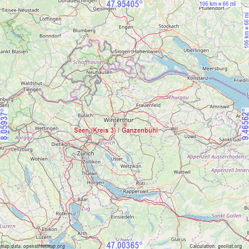
| Upper-left | 47.95405°, | 8.05937° |
| Center: | 47.481°, | 8.76249° |
| Lower-right: | 47.00365°, | 9.46562° |
| Map W x H: | 105.7×105.7 km | = 65.7×65.7mi |
| max Lat: | 47.76737° ⇑13.6% North |
| Seen (Kreis 3) / Ganzenbühl: | 47.481° |
| min Lat: | ⇓86.4% South 45.83203° |
| min Long | Seen (Kreis 3) | max Long |
| 5.97153° | 8.76249° | 10.44624° |
| W 79%⇐ | ⇒21% E |
Elevation
Elevation of Seen (Kreis 3) / Ganzenbühl is 478 m = 1568 ft, and this is 80.2 m = 263 ft below average elevation for this country.
| Max E: |
1845 m = 6053 ft | 49.8% |
| Avg. | 558.2 m = 1831 ft | |
| Seen (Kreis 3) / Ganzenbühl | 478 m = 1568 ft | |
Min E: |
197 m = 646 ft | 50.2% |
See also: Switzerland elevation on elevation.city.
Geographical zone
Seen (Kreis 3) / Ganzenbühl is located in North temperate zone (between Tropic of Cancer and the Arctic Circle). Distance of this North polar circle is 2121.8 km =1318.4 mi to North.| Distance of | km | miles | from Seen (Kreis 3) / Ganzenbühl |
|---|---|---|---|
| North Pole | 4727.7 | 2937.7 | to North |
| Arctic Circle | 2121.8 | 1318.4 | to North |
| Tropic Cancer | 2673.5 | 1661.2 | to South |
| Equator | 5279.4 | 3280.5 | to South |


Nearby cities:
15 places around Seen (Kreis 3) / Ganzenbühl: (largest is in red/bold)
• Kollbrunn / Kollbrunn (Dorfkern)
2.8 km =1.7 mi,  161°
161°
• Mattenbach (Kreis 7)
1.4 km =0.9 mi,  299°
299°
• Mattenbach (Kreis 7) / Deutweg
2.3 km =1.4 mi,  310°
310°
• Mattenbach (Kreis 7) / Endliker
1.3 km =0.8 mi, 309°
• Mattenbach (Kreis 7) / Gutschick
1.3 km =0.8 mi,  326°
326°
• Oberwinterthur (Kreis 2) / Grüze
2 km =1.2 mi,  348°
348°
• Oberwinterthur (Kreis 2) / Talacker
2.9 km =1.8 mi,  343°
343°
• Seen (Kreis 3)
0.8 km =0.5 mi,  131°
131°
• Seen (Kreis 3) / Büelwiesen
0.4 km =0.2 mi,  27°
27°
• Seen (Kreis 3) / Iberg
2.1 km =1.3 mi,  147°
147°
• Seen (Kreis 3) / Oberseen
0.8 km =0.5 mi,  81°
81°
• Seen (Kreis 3) / Sennhof
1.5 km =0.9 mi,  193°
193°
• Seen (Kreis 3) / Sonnenberg
1.1 km =0.7 mi, 32°
• Seen (Kreis 3) / Waldegg
0.6 km =0.4 mi, 303°
• Seen (Kreis 3) / Waser
0.9 km =0.6 mi, 349°
Sources, notices
• [Note1] Compared only with cities in Switzerland existing in our database
• [Src1] Map data: © OpenStreetMap contributors (CC-BY-SA)
• [Src2] Other city data from geonames.org with taken over terms of usage.
• [Src3] Geographical zone / Annual Mean Temperature by Robert A. Rohde @ Wikipedia
