Rossinière geodata
Rossinière (Vaud) is a populated place; located in Switzerland in Europe/Zurich (GMT+2) time zone. With population of 527 people, there are 1767 cities with bigger population in this country. Compared to other cities in Switzerland, 86.7% of cities are located further ↑North; 85.3% of cities are located further →East and 93.1% of cities have lower elevation than Rossinière. Note1
Administrative division(s):
- Level 1: Vaud
- Level 2: Riviera-Pays-d'Enhaut District
- Level 3: Rossinière


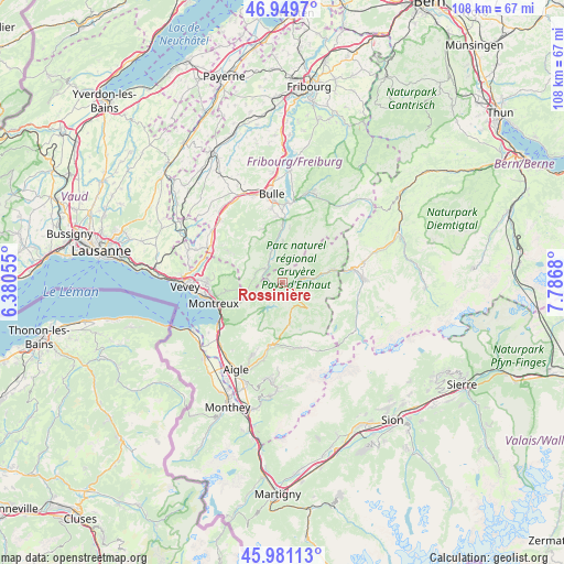
Rossinière GPS coordinates[2]
46° 28' 3.252" North, 7° 5' 1.248" East
| Map corner | latitude | longitude |
|---|---|---|
| Upper-left | 46.9497°, | 6.38055° |
| Center: | 46.46757°, | 7.08368° |
| Lower-right: | 45.98113°, | 7.7868° |
| Map W x H: | 107.7×107.7 km | = 66.9×66.9mi |
| max Lat: | 47.76737° ⇑86.7% North |
| Rossinière: | 46.46757° |
| min Lat: | ⇓13.3% South 45.83203° |
| min Long | Rossinière | max Long |
| 5.97153° | 7.08368° | 10.44624° |
| W 14.7%⇐ | ⇒85.3% E |
Elevation
Elevation of Rossinière is 925 m = 3035 ft, and this is 366.8 m = 1203 ft above average elevation for this country.
| Max E: |
1845 m = 6053 ft | 6.9% |
| Rossinière | 925 m 3035 ft | |
| Avg. | 558.2 m = 1831 ft | |
Min E: |
197 m = 646 ft | 93.1% |
See also: Switzerland elevation on elevation.city.
Geographical zone
Rossinière is located in North temperate zone (between Tropic of Cancer and the Arctic Circle). Distance of this North polar circle is 2234.5 km =1388.5 mi to North.| Distance of | km | miles | from Rossinière |
|---|---|---|---|
| North Pole | 4840.4 | 3007.7 | to North |
| Arctic Circle | 2234.5 | 1388.5 | to North |
| Tropic Cancer | 2560.8 | 1591.2 | to South |
| Equator | 5166.7 | 3210.4 | to South |


Nearby cities:
15 places around Rossinière: (largest is in red/bold)
• Albeuve
5.9 km =3.7 mi,  339°
339°
• Blonay
14.4 km =8.9 mi,  270°
270°
• Broc
15.3 km =9.5 mi,  4°
4°
• Caux
11.8 km =7.3 mi,  250°
250°
• Château-d'Oex
3.7 km =2.3 mi,  78°
78°
• Châtel-Saint-Denis
15.5 km =9.6 mi,  295°
295°
• Enney
11 km =6.8 mi, 0°
• Grandvillard
7.9 km =4.9 mi, 1°
• Gruyères
12.9 km =8 mi,  359°
359°
• Leysin
15 km =9.3 mi,  201°
201°
• Montreux
13.7 km =8.5 mi, 253°
• Rougemont
9.7 km =6 mi, 76°
• Saanen
13.7 km =8.5 mi, 79°
• Veytaux
12.8 km =8 mi, 246°
• Villeneuve
14.3 km =8.9 mi,  237°
237°
Sources, notices
• [Note1] Compared only with cities in Switzerland existing in our database
• [Src1] Map data: © OpenStreetMap contributors (CC-BY-SA)
• [Src2] Other city data from geonames.org with taken over terms of usage.
• [Src3] Geographical zone / Annual Mean Temperature by Robert A. Rohde @ Wikipedia
