Châtel-Saint-Denis geodata
Châtel-Saint-Denis (Fribourg) is a populated place; located in Switzerland in Europe/Zurich (GMT+2) time zone. With population of 5,094 people, there are 334 cities with bigger population in this country. Compared to other cities in Switzerland, 84.6% of cities are located further ↑North; 89.5% of cities are located further →East and 89.3% of cities have lower elevation than Châtel-Saint-Denis. Note1


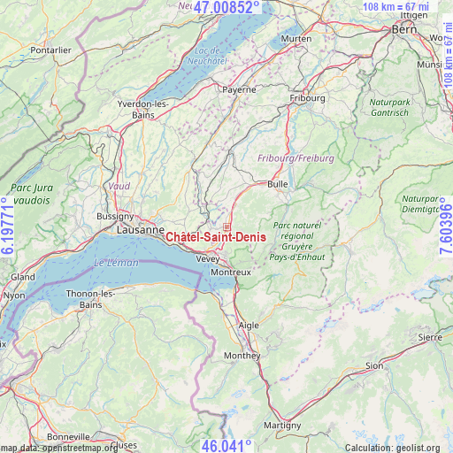
Châtel-Saint-Denis GPS coordinates[2]
46° 31' 36.876" North, 6° 54' 2.988" East
| Map corner | latitude | longitude |
|---|---|---|
| Upper-left | 47.00852°, | 6.19771° |
| Center: | 46.52691°, | 6.90083° |
| Lower-right: | 46.041°, | 7.60396° |
| Map W x H: | 107.6×107.6 km | = 66.9×66.9mi |
| max Lat: | 47.76737° ⇑84.6% North |
| Châtel-Saint-Denis: | 46.52691° |
| min Lat: | ⇓15.4% South 45.83203° |
| min Long | Châtel-Saint-D | max Long |
| 5.97153° | 6.90083° | 10.44624° |
| W 10.5%⇐ | ⇒89.5% E |
Elevation
Elevation of Châtel-Saint-Denis is 809 m = 2654 ft, and this is 250.8 m = 823 ft above average elevation for this country.
| Max E: |
1845 m = 6053 ft | 10.7% |
| Châtel-Saint-Denis | 809 m 2654 ft | |
| Avg. | 558.2 m = 1831 ft | |
Min E: |
197 m = 646 ft | 89.3% |
See also: Switzerland elevation on elevation.city.
Geographical zone
Châtel-Saint-Denis is located in North temperate zone (between Tropic of Cancer and the Arctic Circle). Distance of this North polar circle is 2227.9 km =1384.4 mi to North.| Distance of | km | miles | from Châtel-Saint-Denis |
|---|---|---|---|
| North Pole | 4833.8 | 3003.6 | to North |
| Arctic Circle | 2227.9 | 1384.4 | to North |
| Tropic Cancer | 2567.4 | 1595.3 | to South |
| Equator | 5173.3 | 3214.5 | to South |


Nearby cities:
15 places around Châtel-Saint-Denis: (largest is in red/bold)
• Attalens
4.5 km =2.8 mi,  238°
238°
• Blonay
6.6 km =4.1 mi,  183°
183°
• Chardonne
7.9 km =4.9 mi,  225°
225°
• Chexbres
10.6 km =6.6 mi, 242°
• Jongny
7 km =4.3 mi,  220°
220°
• La Tour-de-Peilz
8.8 km =5.5 mi,  201°
201°
• Maracon
3.4 km =2.1 mi,  319°
319°
• Montreux
10.5 km =6.5 mi, 175°
• Oron-la-Ville
7.6 km =4.7 mi,  310°
310°
• Palézieux
5 km =3.1 mi,  289°
289°
• Puidoux
9.5 km =5.9 mi,  252°
252°
• Saint Saphorin
10 km =6.2 mi, 233°
• Semsales
5.6 km =3.5 mi,  23°
23°
• St-Légier-La Chiésaz
6.4 km =4 mi, 198°
• Vevey
8.4 km =5.2 mi,  211°
211°
Sources, notices
• [Note1] Compared only with cities in Switzerland existing in our database
• [Src1] Map data: © OpenStreetMap contributors (CC-BY-SA)
• [Src2] Other city data from geonames.org with taken over terms of usage.
• [Src3] Geographical zone / Annual Mean Temperature by Robert A. Rohde @ Wikipedia
