Richenthal geodata
Richenthal (Lucerne) is a populated place; located in Switzerland in Europe/Zurich (GMT+2) time zone. With population of 769 people, there are 1514 cities with bigger population in this country. Compared to other cities in Switzerland, 51.2% of cities are located further ↑North; 61.6% of cities are located further →East and 56.4% of cities have lower elevation than Richenthal. Note1


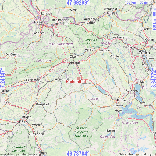
Richenthal GPS coordinates[2]
47° 13' 3.252" North, 7° 56' 40.524" East
| Map corner | latitude | longitude |
|---|---|---|
| Upper-left | 47.69299°, | 7.24147° |
| Center: | 47.21757°, | 7.94459° |
| Lower-right: | 46.73784°, | 8.64772° |
| Map W x H: | 106.2×106.2 km | = 66×66mi |
| max Lat: | 47.76737° ⇑51.2% North |
| Richenthal: | 47.21757° |
| min Lat: | ⇓48.8% South 45.83203° |
| min Long | Richenthal | max Long |
| 5.97153° | 7.94459° | 10.44624° |
| W 38.4%⇐ | ⇒61.6% E |
Elevation
Elevation of Richenthal is 503 m = 1650 ft, and this is 55.2 m = 181 ft below average elevation for this country.
| Max E: |
1845 m = 6053 ft | 43.6% |
| Avg. | 558.2 m = 1831 ft | |
| Richenthal | 503 m = 1650 ft | |
Min E: |
197 m = 646 ft | 56.4% |
See also: Switzerland elevation on elevation.city.
Geographical zone
Richenthal is located in North temperate zone (between Tropic of Cancer and the Arctic Circle). Distance of this North polar circle is 2151.1 km =1336.6 mi to North.| Distance of | km | miles | from Richenthal |
|---|---|---|---|
| North Pole | 4757 | 2955.9 | to North |
| Arctic Circle | 2151.1 | 1336.6 | to North |
| Tropic Cancer | 2644.2 | 1643 | to South |
| Equator | 5250.1 | 3262.3 | to South |


Nearby cities:
15 places around Richenthal: (largest is in red/bold)
• Altishofen
2.8 km =1.7 mi,  137°
137°
• Brittnau
4.7 km =2.9 mi,  2°
2°
• Dagmersellen
3.1 km =1.9 mi,  97°
97°
• Melchnau
8.1 km =5 mi,  240°
240°
• Nebikon
3.8 km =2.4 mi, 138°
• Pfaffnau
3.8 km =2.4 mi,  287°
287°
• Reiden
3.9 km =2.4 mi,  31°
31°
• Schötz
6.3 km =3.9 mi,  148°
148°
• Strengelbach
7 km =4.3 mi,  350°
350°
• Uffikon
5.6 km =3.5 mi, 97°
• Vordemwald
7.3 km =4.5 mi,  333°
333°
• Wauwil
6.8 km =4.2 mi,  122°
122°
• Wikon
5.4 km =3.4 mi,  19°
19°
• Winikon
8.1 km =5 mi,  75°
75°
• Zofingen
7.8 km =4.8 mi, 0°
Sources, notices
• [Note1] Compared only with cities in Switzerland existing in our database
• [Src1] Map data: © OpenStreetMap contributors (CC-BY-SA)
• [Src2] Other city data from geonames.org with taken over terms of usage.
• [Src3] Geographical zone / Annual Mean Temperature by Robert A. Rohde @ Wikipedia
