Dagmersellen geodata
Dagmersellen (Lucerne) is a populated place; located in Switzerland in Europe/Zurich (GMT+2) time zone. With population of 3,300 people, there are 529 cities with bigger population in this country. Compared to other cities in Switzerland, 51.5% of cities are located further ↑North; 60.8% of cities are located further →East and 50.8% of cities have lower elevation than Dagmersellen. Note1


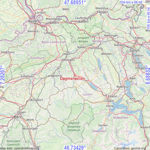
Dagmersellen GPS coordinates[2]
47° 12' 50.58" North, 7° 59' 6.684" East
| Map corner | latitude | longitude |
|---|---|---|
| Upper-left | 47.68951°, | 7.28207° |
| Center: | 47.21405°, | 7.98519° |
| Lower-right: | 46.73429°, | 8.68832° |
| Map W x H: | 106.2×106.2 km | = 66×66mi |
| max Lat: | 47.76737° ⇑51.5% North |
| Dagmersellen: | 47.21405° |
| min Lat: | ⇓48.5% South 45.83203° |
| min Long | Dagmersellen | max Long |
| 5.97153° | 7.98519° | 10.44624° |
| W 39.2%⇐ | ⇒60.8% E |
Elevation
Elevation of Dagmersellen is 479 m = 1572 ft, and this is 79.2 m = 260 ft below average elevation for this country.
| Max E: |
1845 m = 6053 ft | 49.2% |
| Avg. | 558.2 m = 1831 ft | |
| Dagmersellen | 479 m = 1572 ft | |
Min E: |
197 m = 646 ft | 50.8% |
See also: Switzerland elevation on elevation.city.
Geographical zone
Dagmersellen is located in North temperate zone (between Tropic of Cancer and the Arctic Circle). Distance of this North polar circle is 2151.5 km =1336.9 mi to North.| Distance of | km | miles | from Dagmersellen |
|---|---|---|---|
| North Pole | 4757.4 | 2956.1 | to North |
| Arctic Circle | 2151.5 | 1336.9 | to North |
| Tropic Cancer | 2643.8 | 1642.8 | to South |
| Equator | 5249.7 | 3262 | to South |


Nearby cities:
15 places around Dagmersellen: (largest is in red/bold)
• Alberswil
7.3 km =4.5 mi,  169°
169°
• Altishofen
2 km =1.2 mi,  215°
215°
• Brittnau
5.8 km =3.6 mi,  330°
330°
• Ettiswil
7.5 km =4.7 mi,  160°
160°
• Knutwil
6.8 km =4.2 mi,  103°
103°
• Nebikon
2.5 km =1.6 mi,  192°
192°
• Pfaffnau
6.8 km =4.2 mi,  282°
282°
• Reiden
3.8 km =2.4 mi,  344°
344°
• Richenthal
3.1 km =1.9 mi, 277°
• Schötz
5 km =3.1 mi,  176°
176°
• Triengen
7.3 km =4.5 mi,  70°
70°
• Uffikon
2.5 km =1.6 mi, 97°
• Wauwil
4.3 km =2.7 mi,  140°
140°
• Wikon
5.6 km =3.5 mi,  346°
346°
• Winikon
5.4 km =3.4 mi,  62°
62°
Sources, notices
• [Note1] Compared only with cities in Switzerland existing in our database
• [Src1] Map data: © OpenStreetMap contributors (CC-BY-SA)
• [Src2] Other city data from geonames.org with taken over terms of usage.
• [Src3] Geographical zone / Annual Mean Temperature by Robert A. Rohde @ Wikipedia
