Pfaffnau geodata
Pfaffnau (Lucerne) is a populated place; located in Switzerland in Europe/Zurich (GMT+2) time zone. With population of 2,047 people, there are 819 cities with bigger population in this country. Compared to other cities in Switzerland, 50.5% of cities are located further ↑North; 62.6% of cities are located further →East and 56.9% of cities have lower elevation than Pfaffnau. Note1


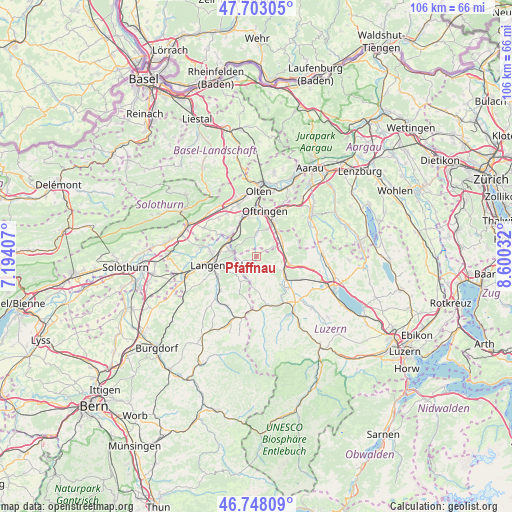
Pfaffnau GPS coordinates[2]
47° 13' 39.792" North, 7° 53' 49.884" East
| Map corner | latitude | longitude |
|---|---|---|
| Upper-left | 47.70305°, | 7.19407° |
| Center: | 47.22772°, | 7.89719° |
| Lower-right: | 46.74809°, | 8.60032° |
| Map W x H: | 106.2×106.2 km | = 66×66mi |
| max Lat: | 47.76737° ⇑50.5% North |
| Pfaffnau: | 47.22772° |
| min Lat: | ⇓49.5% South 45.83203° |
| min Long | Pfaffnau | max Long |
| 5.97153° | 7.89719° | 10.44624° |
| W 37.4%⇐ | ⇒62.6% E |
Elevation
Elevation of Pfaffnau is 504 m = 1654 ft, and this is 54.2 m = 178 ft below average elevation for this country.
| Max E: |
1845 m = 6053 ft | 43.1% |
| Avg. | 558.2 m = 1831 ft | |
| Pfaffnau | 504 m = 1654 ft | |
Min E: |
197 m = 646 ft | 56.9% |
See also: Switzerland elevation on elevation.city.
Geographical zone
Pfaffnau is located in North temperate zone (between Tropic of Cancer and the Arctic Circle). Distance of this North polar circle is 2149.9 km =1335.9 mi to North.| Distance of | km | miles | from Pfaffnau |
|---|---|---|---|
| North Pole | 4755.8 | 2955.1 | to North |
| Arctic Circle | 2149.9 | 1335.9 | to North |
| Tropic Cancer | 2645.3 | 1643.7 | to South |
| Equator | 5251.2 | 3262.9 | to South |


Nearby cities:
15 places around Pfaffnau: (largest is in red/bold)
• Altishofen
6.3 km =3.9 mi,  120°
120°
• Brittnau
5.2 km =3.2 mi,  46°
46°
• Busswil bei Melchnau
6.8 km =4.2 mi,  226°
226°
• Dagmersellen
6.8 km =4.2 mi,  102°
102°
• Fulenbach
6.9 km =4.3 mi,  314°
314°
• Melchnau
6.1 km =3.8 mi,  214°
214°
• Murgenthal
6.5 km =4 mi,  318°
318°
• Nebikon
7.3 km =4.5 mi, 123°
• Reiden
6 km =3.7 mi,  68°
68°
• Richenthal
3.8 km =2.4 mi,  107°
107°
• Roggwil
5.9 km =3.7 mi,  284°
284°
• Strengelbach
6.2 km =3.9 mi,  22°
22°
• Vordemwald
5.4 km =3.4 mi,  3°
3°
• Wikon
6.7 km =4.2 mi, 53°
• Wynau
6.9 km =4.3 mi,  296°
296°
Sources, notices
• [Note1] Compared only with cities in Switzerland existing in our database
• [Src1] Map data: © OpenStreetMap contributors (CC-BY-SA)
• [Src2] Other city data from geonames.org with taken over terms of usage.
• [Src3] Geographical zone / Annual Mean Temperature by Robert A. Rohde @ Wikipedia
