Kerzers geodata
Kerzers (Fribourg) is a populated place; located in Switzerland in Europe/Zurich (GMT+2) time zone. With population of 4,459 people, there are 388 cities with bigger population in this country. Compared to other cities in Switzerland, 65.7% of cities are located further ↑North; 82.4% of cities are located further →East and 59.8% of cities have higher elevation than Kerzers. Note1


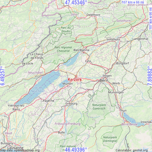
Kerzers GPS coordinates[2]
46° 58' 33.096" North, 7° 11' 44.52" East
| Map corner | latitude | longitude |
|---|---|---|
| Upper-left | 47.45346°, | 6.49257° |
| Center: | 46.97586°, | 7.1957° |
| Lower-right: | 46.49396°, | 7.89882° |
| Map W x H: | 106.7×106.7 km | = 66.3×66.3mi |
| max Lat: | 47.76737° ⇑65.7% North |
| Kerzers: | 46.97586° |
| min Lat: | ⇓34.3% South 45.83203° |
| min Long | Kerzers | max Long |
| 5.97153° | 7.1957° | 10.44624° |
| W 17.6%⇐ | ⇒82.4% E |
Elevation
Elevation of Kerzers is 455 m = 1493 ft, and this is 103.2 m = 339 ft below average elevation for this country.
| Max E: |
1845 m = 6053 ft | 59.8% |
| Avg. | 558.2 m = 1831 ft | |
| Kerzers | 455 m = 1493 ft | |
Min E: |
197 m = 646 ft | 40.2% |
See also: Switzerland elevation on elevation.city.
Geographical zone
Kerzers is located in North temperate zone (between Tropic of Cancer and the Arctic Circle). Distance of this North polar circle is 2177.9 km =1353.3 mi to North.| Distance of | km | miles | from Kerzers |
|---|---|---|---|
| North Pole | 4783.8 | 2972.5 | to North |
| Arctic Circle | 2177.9 | 1353.3 | to North |
| Tropic Cancer | 2617.3 | 1626.3 | to South |
| Equator | 5223.2 | 3245.5 | to South |


Nearby cities:
15 places around Kerzers: (largest is in red/bold)
• Bas-Vully
6.5 km =4 mi,  256°
256°
• Brüttelen
6.3 km =3.9 mi,  325°
325°
• Ferenbalm
3.2 km =2 mi,  158°
158°
• Galmiz
4.2 km =2.6 mi,  223°
223°
• Ins
7.6 km =4.7 mi,  296°
296°
• Jeuss
8.4 km =5.2 mi,  197°
197°
• Kallnach
5.8 km =3.6 mi,  31°
31°
• Laupen
8.9 km =5.5 mi, 157°
• Liebistorf
7.5 km =4.7 mi,  179°
179°
• Murten/Morat
8 km =5 mi,  228°
228°
• Mühleberg
5.5 km =3.4 mi,  115°
115°
• Münchenwiler
8.8 km =5.5 mi, 217°
• Müntschemier
4.3 km =2.7 mi, 300°
• Radelfingen
7.7 km =4.8 mi,  48°
48°
• Siselen
6.3 km =3.9 mi,  355°
355°
Sources, notices
• [Note1] Compared only with cities in Switzerland existing in our database
• [Src1] Map data: © OpenStreetMap contributors (CC-BY-SA)
• [Src2] Other city data from geonames.org with taken over terms of usage.
• [Src3] Geographical zone / Annual Mean Temperature by Robert A. Rohde @ Wikipedia
