Lütisburg geodata
Lütisburg (Saint Gallen) is a populated place; located in Switzerland in Europe/Zurich (GMT+2) time zone. With population of 1,476 people, there are 1045 cities with bigger population in this country. Compared to other cities in Switzerland, 72.3% of cities are located further ↓South; 90.5% of cities are located further ←West and 71.2% of cities have lower elevation than Lütisburg. Note1


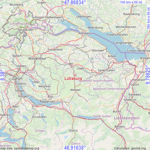
Lütisburg GPS coordinates[2]
47° 23' 40.236" North, 9° 4' 59.232" East
| Map corner | latitude | longitude |
|---|---|---|
| Upper-left | 47.86834°, | 8.38° |
| Center: | 47.39451°, | 9.08312° |
| Lower-right: | 46.91638°, | 9.78625° |
| Map W x H: | 105.8×105.8 km | = 65.7×65.7mi |
| max Lat: | 47.76737° ⇑27.7% North |
| Lütisburg: | 47.39451° |
| min Lat: | ⇓72.3% South 45.83203° |
| min Long | Lütisburg | max Long |
| 5.97153° | 9.08312° | 10.44624° |
| W 90.5%⇐ | ⇒9.5% E |
Elevation
Elevation of Lütisburg is 582 m = 1909 ft, and this is 23.8 m = 78 ft above average elevation for this country.
| Max E: |
1845 m = 6053 ft | 28.8% |
| Lütisburg | 582 m 1909 ft | |
| Avg. | 558.2 m = 1831 ft | |
Min E: |
197 m = 646 ft | 71.2% |
See also: Switzerland elevation on elevation.city.
Geographical zone
Lütisburg is located in North temperate zone (between Tropic of Cancer and the Arctic Circle). Distance of this North polar circle is 2131.4 km =1324.4 mi to North.| Distance of | km | miles | from Lütisburg |
|---|---|---|---|
| North Pole | 4737.3 | 2943.6 | to North |
| Arctic Circle | 2131.4 | 1324.4 | to North |
| Tropic Cancer | 2663.9 | 1655.3 | to South |
| Equator | 5269.8 | 3274.5 | to South |


Nearby cities:
15 places around Lütisburg: (largest is in red/bold)
• Brunnadern
7.4 km =4.6 mi,  151°
151°
• Bütschwil
3.9 km =2.4 mi,  192°
192°
• Fischingen
8.9 km =5.5 mi,  284°
284°
• Flawil
7.8 km =4.8 mi,  74°
74°
• Ganterschwil
1.7 km =1.1 mi,  155°
155°
• Jonschwil
3.3 km =2.1 mi,  4°
4°
• Kirchberg
3.7 km =2.3 mi,  300°
300°
• Lichtensteig
7.9 km =4.9 mi,  177°
177°
• Mogelsberg
5.3 km =3.3 mi,  132°
132°
• Mosnang
4.7 km =2.9 mi,  220°
220°
• Oberhelfenschwil
4.7 km =2.9 mi, 153°
• Oberuzwil
5.2 km =3.2 mi,  39°
39°
• Rickenbach bei Wil
6.5 km =4 mi,  336°
336°
• Uzwil
6.1 km =3.8 mi, 39°
• Wil
8 km =5 mi, 339°
Sources, notices
• [Note1] Compared only with cities in Switzerland existing in our database
• [Src1] Map data: © OpenStreetMap contributors (CC-BY-SA)
• [Src2] Other city data from geonames.org with taken over terms of usage.
• [Src3] Geographical zone / Annual Mean Temperature by Robert A. Rohde @ Wikipedia
