Ganterschwil geodata
Ganterschwil (Saint Gallen) is a populated place; located in Switzerland in Europe/Zurich (GMT+2) time zone. With population of 1,145 people, there are 1234 cities with bigger population in this country. Compared to other cities in Switzerland, 69.2% of cities are located further ↓South; 90.8% of cities are located further ←West and 75.2% of cities have lower elevation than Ganterschwil. Note1
Administrative division(s):
- Level 1: Saint Gallen
- Level 2: Wahlkreis Toggenburg
- Level 3: Bütschwil-Ganterschwil


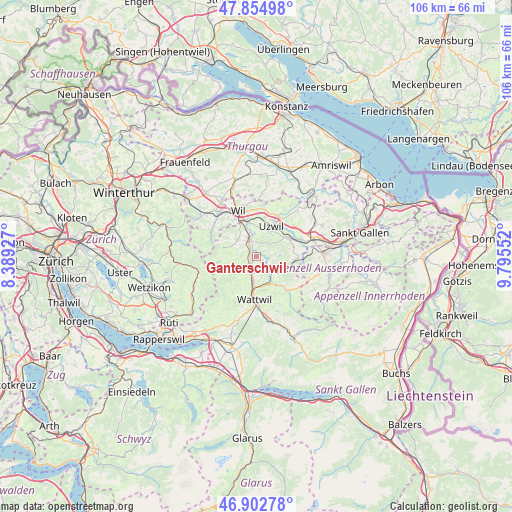
Ganterschwil GPS coordinates[2]
47° 22' 51.708" North, 9° 5' 32.604" East
| Map corner | latitude | longitude |
|---|---|---|
| Upper-left | 47.85498°, | 8.38927° |
| Center: | 47.38103°, | 9.09239° |
| Lower-right: | 46.90278°, | 9.79552° |
| Map W x H: | 105.9×105.9 km | = 65.8×65.8mi |
| max Lat: | 47.76737° ⇑30.8% North |
| Ganterschwil: | 47.38103° |
| min Lat: | ⇓69.2% South 45.83203° |
| min Long | Ganterschwil | max Long |
| 5.97153° | 9.09239° | 10.44624° |
| W 90.8%⇐ | ⇒9.2% E |
Elevation
Elevation of Ganterschwil is 619 m = 2031 ft, and this is 60.8 m = 199 ft above average elevation for this country.
| Max E: |
1845 m = 6053 ft | 24.8% |
| Ganterschwil | 619 m 2031 ft | |
| Avg. | 558.2 m = 1831 ft | |
Min E: |
197 m = 646 ft | 75.2% |
See also: Switzerland elevation on elevation.city.
Geographical zone
Ganterschwil is located in North temperate zone (between Tropic of Cancer and the Arctic Circle). Distance of this North polar circle is 2132.9 km =1325.3 mi to North.| Distance of | km | miles | from Ganterschwil |
|---|---|---|---|
| North Pole | 4738.8 | 2944.6 | to North |
| Arctic Circle | 2132.9 | 1325.3 | to North |
| Tropic Cancer | 2662.4 | 1654.3 | to South |
| Equator | 5268.3 | 3273.6 | to South |


Nearby cities:
15 places around Ganterschwil: (largest is in red/bold)
• Brunnadern
5.8 km =3.6 mi,  150°
150°
• Bütschwil
2.8 km =1.7 mi,  213°
213°
• Degersheim
8.2 km =5.1 mi,  95°
95°
• Flawil
7.7 km =4.8 mi,  62°
62°
• Jonschwil
4.8 km =3 mi,  355°
355°
• Kirchberg
5.2 km =3.2 mi,  310°
310°
• Lichtensteig
6.4 km =4 mi,  183°
183°
• Lütisburg
1.7 km =1.1 mi,  335°
335°
• Mogelsberg
3.9 km =2.4 mi,  122°
122°
• Mosnang
4.3 km =2.7 mi,  241°
241°
• Oberhelfenschwil
3 km =1.9 mi, 152°
• Oberuzwil
6.1 km =3.8 mi,  25°
25°
• Rickenbach bei Wil
8.2 km =5.1 mi, 336°
• Uzwil
6.9 km =4.3 mi, 27°
• Wattwil
9.1 km =5.7 mi, 182°
Sources, notices
• [Note1] Compared only with cities in Switzerland existing in our database
• [Src1] Map data: © OpenStreetMap contributors (CC-BY-SA)
• [Src2] Other city data from geonames.org with taken over terms of usage.
• [Src3] Geographical zone / Annual Mean Temperature by Robert A. Rohde @ Wikipedia
