Oberhelfenschwil geodata
Oberhelfenschwil (Saint Gallen) is a populated place; located in Switzerland in Europe/Zurich (GMT+2) time zone. With population of 1,318 people, there are 1125 cities with bigger population in this country. Compared to other cities in Switzerland, 65.4% of cities are located further ↓South; 91.2% of cities are located further ←West and 90.2% of cities have lower elevation than Oberhelfenschwil. Note1
Administrative division(s):
- Level 1: Saint Gallen
- Level 2: Wahlkreis Toggenburg
- Level 3: Oberhelfenschwil


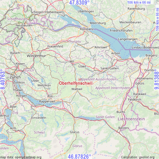
Oberhelfenschwil GPS coordinates[2]
47° 21' 24.228" North, 9° 6' 38.736" East
| Map corner | latitude | longitude |
|---|---|---|
| Upper-left | 47.8309°, | 8.40763° |
| Center: | 47.35673°, | 9.11076° |
| Lower-right: | 46.87826°, | 9.81388° |
| Map W x H: | 105.9×105.9 km | = 65.8×65.8mi |
| max Lat: | 47.76737° ⇑34.6% North |
| Oberhelfenschwil: | 47.35673° |
| min Lat: | ⇓65.4% South 45.83203° |
| min Long | Oberhelfenschwi | max Long |
| 5.97153° | 9.11076° | 10.44624° |
| W 91.2%⇐ | ⇒8.8% E |
Elevation
Elevation of Oberhelfenschwil is 825 m = 2707 ft, and this is 266.8 m = 875 ft above average elevation for this country.
| Max E: |
1845 m = 6053 ft | 9.8% |
| Oberhelfenschwil | 825 m 2707 ft | |
| Avg. | 558.2 m = 1831 ft | |
Min E: |
197 m = 646 ft | 90.2% |
See also: Switzerland elevation on elevation.city.
Geographical zone
Oberhelfenschwil is located in North temperate zone (between Tropic of Cancer and the Arctic Circle). Distance of this North polar circle is 2135.6 km =1327 mi to North.| Distance of | km | miles | from Oberhelfenschwil |
|---|---|---|---|
| North Pole | 4741.5 | 2946.2 | to North |
| Arctic Circle | 2135.6 | 1327 | to North |
| Tropic Cancer | 2659.7 | 1652.7 | to South |
| Equator | 5265.6 | 3271.9 | to South |


Nearby cities:
15 places around Oberhelfenschwil: (largest is in red/bold)
• Brunnadern
2.7 km =1.7 mi,  147°
147°
• Bütschwil
2.9 km =1.8 mi,  277°
277°
• Degersheim
7 km =4.3 mi,  73°
73°
• Flawil
8.3 km =5.2 mi,  41°
41°
• Ganterschwil
3 km =1.9 mi,  332°
332°
• Hemberg
7.9 km =4.9 mi,  142°
142°
• Jonschwil
7.7 km =4.8 mi,  346°
346°
• Kirchberg
8.1 km =5 mi,  318°
318°
• Lichtensteig
4.1 km =2.5 mi,  205°
205°
• Lütisburg
4.7 km =2.9 mi, 333°
• Mogelsberg
2 km =1.2 mi, 71°
• Mosnang
5.1 km =3.2 mi, 277°
• Oberuzwil
8.3 km =5.2 mi,  8°
8°
• Sankt Peterzell
6.5 km =4 mi,  131°
131°
• Wattwil
6.6 km =4.1 mi,  195°
195°
Sources, notices
• [Note1] Compared only with cities in Switzerland existing in our database
• [Src1] Map data: © OpenStreetMap contributors (CC-BY-SA)
• [Src2] Other city data from geonames.org with taken over terms of usage.
• [Src3] Geographical zone / Annual Mean Temperature by Robert A. Rohde @ Wikipedia
