Lichtensteig geodata
Lichtensteig (Saint Gallen) is a seat of a second-order administrative division; located in Switzerland in Europe/Zurich (GMT+2) time zone. With population of 1,945 people, there are 851 cities with bigger population in this country. Compared to other cities in Switzerland, 61.4% of cities are located further ↓South; 90.7% of cities are located further ←West and 77.5% of cities have lower elevation than Lichtensteig. Note1
Administrative division(s):
- Level 1: Saint Gallen
- Level 2: Wahlkreis Toggenburg
- Level 3: Lichtensteig


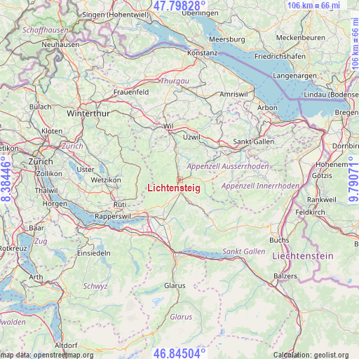
Lichtensteig GPS coordinates[2]
47° 19' 25.716" North, 9° 5' 15.288" East
| Map corner | latitude | longitude |
|---|---|---|
| Upper-left | 47.79828°, | 8.38446° |
| Center: | 47.32381°, | 9.08758° |
| Lower-right: | 46.84504°, | 9.79071° |
| Map W x H: | 106×106 km | = 65.9×65.9mi |
| max Lat: | 47.76737° ⇑38.6% North |
| Lichtensteig: | 47.32381° |
| min Lat: | ⇓61.4% South 45.83203° |
| min Long | Lichtensteig | max Long |
| 5.97153° | 9.08758° | 10.44624° |
| W 90.7%⇐ | ⇒9.3% E |
Elevation
Elevation of Lichtensteig is 638 m = 2093 ft, and this is 79.8 m = 262 ft above average elevation for this country.
| Max E: |
1845 m = 6053 ft | 22.5% |
| Lichtensteig | 638 m 2093 ft | |
| Avg. | 558.2 m = 1831 ft | |
Min E: |
197 m = 646 ft | 77.5% |
See also: Switzerland elevation on elevation.city.
Geographical zone
Lichtensteig is located in North temperate zone (between Tropic of Cancer and the Arctic Circle). Distance of this North polar circle is 2139.3 km =1329.3 mi to North.| Distance of | km | miles | from Lichtensteig |
|---|---|---|---|
| North Pole | 4745.1 | 2948.5 | to North |
| Arctic Circle | 2139.3 | 1329.3 | to North |
| Tropic Cancer | 2656 | 1650.4 | to South |
| Equator | 5261.9 | 3269.6 | to South |


Nearby cities:
15 places around Lichtensteig: (largest is in red/bold)
• Brunnadern
3.5 km =2.2 mi,  67°
67°
• Bütschwil
4.2 km =2.6 mi,  343°
343°
• Degersheim
10.2 km =6.3 mi,  56°
56°
• Ebnat-Kappel
7.4 km =4.6 mi,  157°
157°
• Ganterschwil
6.4 km =4 mi,  3°
3°
• Hemberg
7.1 km =4.4 mi,  111°
111°
• Jonschwil
11.1 km =6.9 mi,  359°
359°
• Kirchberg
10.4 km =6.5 mi, 339°
• Krummenau
10.5 km =6.5 mi,  143°
143°
• Lütisburg
7.9 km =4.9 mi, 357°
• Mogelsberg
5.6 km =3.5 mi,  40°
40°
• Mosnang
5.5 km =3.4 mi,  322°
322°
• Oberhelfenschwil
4.1 km =2.5 mi,  25°
25°
• Sankt Peterzell
6.7 km =4.2 mi,  95°
95°
• Wattwil
2.7 km =1.7 mi,  181°
181°
Sources, notices
• [Note1] Compared only with cities in Switzerland existing in our database
• [Src1] Map data: © OpenStreetMap contributors (CC-BY-SA)
• [Src2] Other city data from geonames.org with taken over terms of usage.
• [Src3] Geographical zone / Annual Mean Temperature by Robert A. Rohde @ Wikipedia
