Kaisten geodata
Kaisten (Aargau) is a populated place; located in Switzerland in Europe/Zurich (GMT+2) time zone. With population of 2,140 people, there are 796 cities with bigger population in this country. Compared to other cities in Switzerland, 94.3% of cities are located further ↓South; 59.4% of cities are located further →East and 96.4% of cities have higher elevation than Kaisten. Note1


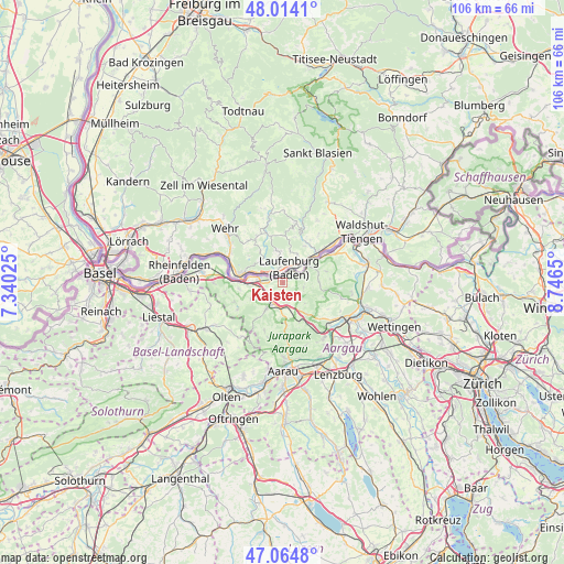
Kaisten GPS coordinates[2]
47° 32' 29.76" North, 8° 2' 36.132" East
| Map corner | latitude | longitude |
|---|---|---|
| Upper-left | 48.0141°, | 7.34025° |
| Center: | 47.5416°, | 8.04337° |
| Lower-right: | 47.0648°, | 8.7465° |
| Map W x H: | 105.6×105.6 km | = 65.6×65.6mi |
| max Lat: | 47.76737° ⇑5.7% North |
| Kaisten: | 47.5416° |
| min Lat: | ⇓94.3% South 45.83203° |
| min Long | Kaisten | max Long |
| 5.97153° | 8.04337° | 10.44624° |
| W 40.6%⇐ | ⇒59.4% E |
Elevation
Elevation of Kaisten is 329 m = 1079 ft, and this is 229.2 m = 752 ft below average elevation for this country.
| Max E: |
1845 m = 6053 ft | 96.4% |
| Avg. | 558.2 m = 1831 ft | |
| Kaisten | 329 m = 1079 ft | |
Min E: |
197 m = 646 ft | 3.6% |
See also: Switzerland elevation on elevation.city.
Geographical zone
Kaisten is located in North temperate zone (between Tropic of Cancer and the Arctic Circle). Distance of this North polar circle is 2115 km =1314.2 mi to North.| Distance of | km | miles | from Kaisten |
|---|---|---|---|
| North Pole | 4720.9 | 2933.4 | to North |
| Arctic Circle | 2115 | 1314.2 | to North |
| Tropic Cancer | 2680.2 | 1665.4 | to South |
| Equator | 5286.1 | 3284.6 | to South |


Nearby cities:
15 places around Kaisten: (largest is in red/bold)
• Bözen
6 km =3.7 mi,  148°
148°
• Effingen
7.4 km =4.6 mi,  142°
142°
• Eiken
4.2 km =2.6 mi,  257°
257°
• Frick
3.6 km =2.2 mi,  202°
202°
• Gansingen
6.9 km =4.3 mi,  88°
88°
• Gipf-Oberfrick
5.6 km =3.5 mi,  211°
211°
• Hornussen
4.8 km =3 mi,  162°
162°
• Laufenburg
2.5 km =1.6 mi,  34°
34°
• Mumpf
9.2 km =5.7 mi,  272°
272°
• Schwaderloch
9 km =5.6 mi,  57°
57°
• Stein
6.8 km =4.2 mi, 272°
• Sulz
4 km =2.5 mi,  98°
98°
• Wittnau
8.4 km =5.2 mi,  217°
217°
• Wölflinswil
9.6 km =6 mi, 200°
• Zeihen
7.9 km =4.9 mi, 156°
Sources, notices
• [Note1] Compared only with cities in Switzerland existing in our database
• [Src1] Map data: © OpenStreetMap contributors (CC-BY-SA)
• [Src2] Other city data from geonames.org with taken over terms of usage.
• [Src3] Geographical zone / Annual Mean Temperature by Robert A. Rohde @ Wikipedia
