Gansingen geodata
Gansingen (Aargau) is a seat of a third-order administrative division; located in Switzerland in Europe/Zurich (GMT+2) time zone. In our database, there are 1823 cities with bigger population. Compared to other cities in Switzerland, 94.4% of cities are located further ↓South; 57.1% of cities are located further →East and 92% of cities have higher elevation than Gansingen. Note1


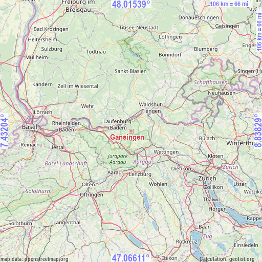
Gansingen GPS coordinates[2]
47° 32' 34.44" North, 8° 8' 6.576" East
| Map corner | latitude | longitude |
|---|---|---|
| Upper-left | 48.01539°, | 7.43204° |
| Center: | 47.5429°, | 8.13516° |
| Lower-right: | 47.06611°, | 8.83829° |
| Map W x H: | 105.6×105.5 km | = 65.6×65.6mi |
| max Lat: | 47.76737° ⇑5.6% North |
| Gansingen: | 47.5429° |
| min Lat: | ⇓94.4% South 45.83203° |
| min Long | Gansingen | max Long |
| 5.97153° | 8.13516° | 10.44624° |
| W 42.9%⇐ | ⇒57.1% E |
Elevation
Elevation of Gansingen is 386 m = 1266 ft, and this is 172.2 m = 565 ft below average elevation for this country.
| Max E: |
1845 m = 6053 ft | 92% |
| Avg. | 558.2 m = 1831 ft | |
| Gansingen | 386 m = 1266 ft | |
Min E: |
197 m = 646 ft | 8% |
See also: Switzerland elevation on elevation.city.
Geographical zone
Gansingen is located in North temperate zone (between Tropic of Cancer and the Arctic Circle). Distance of this North polar circle is 2114.9 km =1314.1 mi to North.| Distance of | km | miles | from Gansingen |
|---|---|---|---|
| North Pole | 4720.8 | 2933.4 | to North |
| Arctic Circle | 2114.9 | 1314.1 | to North |
| Tropic Cancer | 2680.4 | 1665.5 | to South |
| Equator | 5286.3 | 3284.8 | to South |


Nearby cities:
15 places around Gansingen: (largest is in red/bold)
• Brugg
8.8 km =5.5 mi,  141°
141°
• Bözen
6.5 km =4 mi,  215°
215°
• Effingen
6.5 km =4 mi,  201°
201°
• Frick
9 km =5.6 mi,  247°
247°
• Hornussen
7.2 km =4.5 mi,  228°
228°
• Kaisten
6.9 km =4.3 mi,  268°
268°
• Laufenburg
5.8 km =3.6 mi,  289°
289°
• Lauffohr (Brugg)
8.6 km =5.3 mi,  122°
122°
• Leibstadt
5.9 km =3.7 mi,  31°
31°
• Schwaderloch
4.8 km =3 mi,  8°
8°
• Sulz
3 km =1.9 mi,  255°
255°
• Villigen
6.2 km =3.9 mi,  106°
106°
• Villnachern
8.2 km =5.1 mi,  166°
166°
• Würenlingen
9.2 km =5.7 mi,  96°
96°
• Zeihen
8.3 km =5.2 mi,  206°
206°
Sources, notices
• [Note1] Compared only with cities in Switzerland existing in our database
• [Src1] Map data: © OpenStreetMap contributors (CC-BY-SA)
• [Src2] Other city data from geonames.org with taken over terms of usage.
• [Src3] Geographical zone / Annual Mean Temperature by Robert A. Rohde @ Wikipedia
