Horw geodata
Horw (Lucerne) is a seat of a third-order administrative division; located in Switzerland in Europe/Zurich (GMT+2) time zone. With population of 12,348 people, there are 108 cities with bigger population in this country. Compared to other cities in Switzerland, 63.7% of cities are located further ↑North; 52.9% of cities are located further →East and 67.9% of cities have higher elevation than Horw. Note1


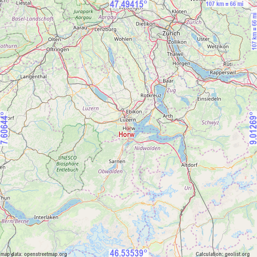
Horw GPS coordinates[2]
47° 1' 0.912" North, 8° 18' 34.416" East
| Map corner | latitude | longitude |
|---|---|---|
| Upper-left | 47.49415°, | 7.60644° |
| Center: | 47.01692°, | 8.30956° |
| Lower-right: | 46.53539°, | 9.01269° |
| Map W x H: | 106.6×106.6 km | = 66.2×66.2mi |
| max Lat: | 47.76737° ⇑63.7% North |
| Horw: | 47.01692° |
| min Lat: | ⇓36.3% South 45.83203° |
| min Long | Horw | max Long |
| 5.97153° | 8.30956° | 10.44624° |
| W 47.1%⇐ | ⇒52.9% E |
Elevation
Elevation of Horw is 441 m = 1447 ft, and this is 117.2 m = 385 ft below average elevation for this country.
| Max E: |
1845 m = 6053 ft | 67.9% |
| Avg. | 558.2 m = 1831 ft | |
| Horw | 441 m = 1447 ft | |
Min E: |
197 m = 646 ft | 32.1% |
See also: Switzerland elevation on elevation.city.
Geographical zone
Horw is located in North temperate zone (between Tropic of Cancer and the Arctic Circle). Distance of this North polar circle is 2173.4 km =1350.5 mi to North.| Distance of | km | miles | from Horw |
|---|---|---|---|
| North Pole | 4779.3 | 2969.7 | to North |
| Arctic Circle | 2173.4 | 1350.5 | to North |
| Tropic Cancer | 2621.9 | 1629.2 | to South |
| Equator | 5227.8 | 3248.4 | to South |


Nearby cities:
15 places around Horw: (largest is in red/bold)
• Adligenswil
6.6 km =4.1 mi,  36°
36°
• Alpnach
8.8 km =5.5 mi,  199°
199°
• Buchrain
9.3 km =5.8 mi,  17°
17°
• Buochs
9.8 km =6.1 mi,  119°
119°
• Ebikon
7.3 km =4.5 mi, 18°
• Emmen
7.3 km =4.5 mi,  338°
338°
• Ennetbürgen
8.4 km =5.2 mi, 115°
• Hergiswil
3.6 km =2.2 mi,  180°
180°
• Kriens
2.4 km =1.5 mi,  310°
310°
• Littau
5.1 km =3.2 mi,  316°
316°
• Luzern
3.7 km =2.3 mi,  356°
356°
• Meggen
6 km =3.7 mi,  55°
55°
• Stans
7.8 km =4.8 mi,  146°
146°
• Stansstad
4.9 km =3 mi,  156°
156°
• Weggis
9.4 km =5.8 mi,  79°
79°
Sources, notices
• [Note1] Compared only with cities in Switzerland existing in our database
• [Src1] Map data: © OpenStreetMap contributors (CC-BY-SA)
• [Src2] Other city data from geonames.org with taken over terms of usage.
• [Src3] Geographical zone / Annual Mean Temperature by Robert A. Rohde @ Wikipedia
