Stansstad geodata
Stansstad (Nidwalden) is a populated place; located in Switzerland in Europe/Zurich (GMT+2) time zone. With population of 4,471 people, there are 386 cities with bigger population in this country. Compared to other cities in Switzerland, 65.6% of cities are located further ↑North; 52.4% of cities are located further →East and 72.7% of cities have higher elevation than Stansstad. Note1


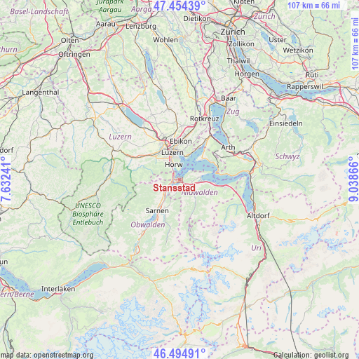
Stansstad GPS coordinates[2]
46° 58' 36.48" North, 8° 20' 7.908" East
| Map corner | latitude | longitude |
|---|---|---|
| Upper-left | 47.45439°, | 7.63241° |
| Center: | 46.9768°, | 8.33553° |
| Lower-right: | 46.49491°, | 9.03866° |
| Map W x H: | 106.7×106.7 km | = 66.3×66.3mi |
| max Lat: | 47.76737° ⇑65.6% North |
| Stansstad: | 46.9768° |
| min Lat: | ⇓34.4% South 45.83203° |
| min Long | Stansstad | max Long |
| 5.97153° | 8.33553° | 10.44624° |
| W 47.6%⇐ | ⇒52.4% E |
Elevation
Elevation of Stansstad is 435 m = 1427 ft, and this is 123.2 m = 404 ft below average elevation for this country.
| Max E: |
1845 m = 6053 ft | 72.7% |
| Avg. | 558.2 m = 1831 ft | |
| Stansstad | 435 m = 1427 ft | |
Min E: |
197 m = 646 ft | 27.3% |
See also: Switzerland elevation on elevation.city.
Geographical zone
Stansstad is located in North temperate zone (between Tropic of Cancer and the Arctic Circle). Distance of this North polar circle is 2177.8 km =1353.2 mi to North.| Distance of | km | miles | from Stansstad |
|---|---|---|---|
| North Pole | 4783.7 | 2972.5 | to North |
| Arctic Circle | 2177.8 | 1353.2 | to North |
| Tropic Cancer | 2617.4 | 1626.4 | to South |
| Equator | 5223.3 | 3245.6 | to South |


Nearby cities:
15 places around Stansstad: (largest is in red/bold)
• Adligenswil
10 km =6.2 mi,  11°
11°
• Alpnach
6.2 km =3.9 mi,  231°
231°
• Buochs
6.6 km =4.1 mi,  92°
92°
• Dallenwil
7.1 km =4.4 mi,  145°
145°
• Ennetbürgen
5.7 km =3.5 mi,  81°
81°
• Hergiswil
2.1 km =1.3 mi,  292°
292°
• Horw
4.9 km =3 mi,  336°
336°
• Kerns
9.6 km =6 mi,  208°
208°
• Kriens
7.1 km =4.4 mi,  327°
327°
• Littau
9.8 km =6.1 mi, 325°
• Luzern
8.5 km =5.3 mi, 344°
• Meggen
8.3 km =5.2 mi,  20°
20°
• Stans
3.1 km =1.9 mi,  131°
131°
• Weggis
9.6 km =6 mi,  50°
50°
• Wolfenschiessen
9.3 km =5.8 mi, 151°
Sources, notices
• [Note1] Compared only with cities in Switzerland existing in our database
• [Src1] Map data: © OpenStreetMap contributors (CC-BY-SA)
• [Src2] Other city data from geonames.org with taken over terms of usage.
• [Src3] Geographical zone / Annual Mean Temperature by Robert A. Rohde @ Wikipedia
