Littau geodata
Littau (Lucerne) is a populated place; located in Switzerland in Europe/Zurich (GMT+2) time zone. With population of 16,121 people, there are 67 cities with bigger population in this country. Compared to other cities in Switzerland, 61.7% of cities are located further ↑North; 53.9% of cities are located further →East and 58.3% of cities have lower elevation than Littau. Note1


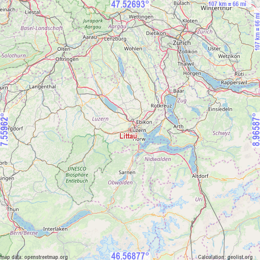
Littau GPS coordinates[2]
47° 3' 0" North, 8° 15' 45.864" East
| Map corner | latitude | longitude |
|---|---|---|
| Upper-left | 47.52693°, | 7.55962° |
| Center: | 47.05°, | 8.26274° |
| Lower-right: | 46.56877°, | 8.96587° |
| Map W x H: | 106.5×106.5 km | = 66.2×66.2mi |
| max Lat: | 47.76737° ⇑61.7% North |
| Littau: | 47.05° |
| min Lat: | ⇓38.3% South 45.83203° |
| min Long | Littau | max Long |
| 5.97153° | 8.26274° | 10.44624° |
| W 46.1%⇐ | ⇒53.9% E |
Elevation
Elevation of Littau is 509 m = 1670 ft, and this is 49.2 m = 161 ft below average elevation for this country.
| Max E: |
1845 m = 6053 ft | 41.7% |
| Avg. | 558.2 m = 1831 ft | |
| Littau | 509 m = 1670 ft | |
Min E: |
197 m = 646 ft | 58.3% |
See also: Switzerland elevation on elevation.city.
Geographical zone
Littau is located in North temperate zone (between Tropic of Cancer and the Arctic Circle). Distance of this North polar circle is 2169.7 km =1348.2 mi to North.| Distance of | km | miles | from Littau |
|---|---|---|---|
| North Pole | 4775.6 | 2967.4 | to North |
| Arctic Circle | 2169.7 | 1348.2 | to North |
| Tropic Cancer | 2625.6 | 1631.5 | to South |
| Equator | 5231.5 | 3250.7 | to South |


Nearby cities:
15 places around Littau: (largest is in red/bold)
• Adligenswil
7.7 km =4.8 mi,  77°
77°
• Buchrain
8.2 km =5.1 mi,  51°
51°
• Ebikon
6.7 km =4.2 mi,  60°
60°
• Emmen
3.2 km =2 mi,  14°
14°
• Hergiswil
8.1 km =5 mi,  154°
154°
• Horw
5.1 km =3.2 mi,  136°
136°
• Inwil
10.6 km =6.6 mi,  37°
37°
• Kriens
2.7 km =1.7 mi, 140°
• Luzern
3.3 km =2.1 mi,  89°
89°
• Malters
6.3 km =3.9 mi,  256°
256°
• Meggen
8.5 km =5.3 mi, 92°
• Neuenkirch
7.1 km =4.4 mi,  321°
321°
• Ruswil
11 km =6.8 mi,  290°
290°
• Schwarzenberg
7.8 km =4.8 mi,  241°
241°
• Stansstad
9.8 km =6.1 mi, 145°
Sources, notices
• [Note1] Compared only with cities in Switzerland existing in our database
• [Src1] Map data: © OpenStreetMap contributors (CC-BY-SA)
• [Src2] Other city data from geonames.org with taken over terms of usage.
• [Src3] Geographical zone / Annual Mean Temperature by Robert A. Rohde @ Wikipedia
