Langwiesen geodata
Langwiesen (Zurich) is a populated place; located in Switzerland in Europe/Zurich (GMT+2) time zone. With population of 759 people, there are 1524 cities with bigger population in this country. Compared to other cities in Switzerland, 99% of cities are located further ↓South; 71.2% of cities are located further ←West and 87.8% of cities have higher elevation than Langwiesen. Note1


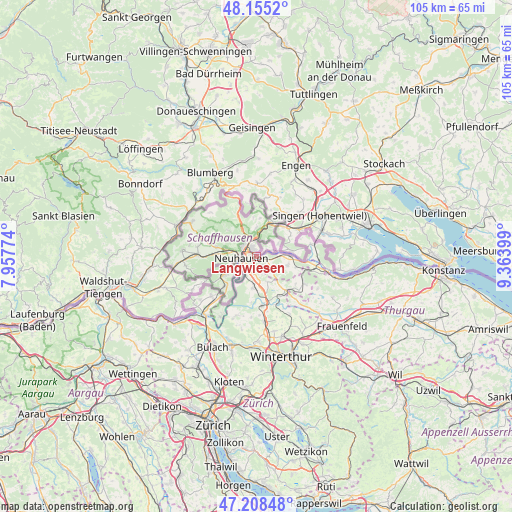
Langwiesen GPS coordinates[2]
47° 41' 2.364" North, 8° 39' 39.096" East
| Map corner | latitude | longitude |
|---|---|---|
| Upper-left | 48.1552°, | 7.95774° |
| Center: | 47.68399°, | 8.66086° |
| Lower-right: | 47.20848°, | 9.36399° |
| Map W x H: | 105.3×105.3 km | = 65.4×65.4mi |
| max Lat: | 47.76737° ⇑1% North |
| Langwiesen: | 47.68399° |
| min Lat: | ⇓99% South 45.83203° |
| min Long | Langwiesen | max Long |
| 5.97153° | 8.66086° | 10.44624° |
| W 71.2%⇐ | ⇒28.8% E |
Elevation
Elevation of Langwiesen is 403 m = 1322 ft, and this is 155.2 m = 509 ft below average elevation for this country.
| Max E: |
1845 m = 6053 ft | 87.8% |
| Avg. | 558.2 m = 1831 ft | |
| Langwiesen | 403 m = 1322 ft | |
Min E: |
197 m = 646 ft | 12.2% |
See also: Switzerland elevation on elevation.city.
Geographical zone
Langwiesen is located in North temperate zone (between Tropic of Cancer and the Arctic Circle). Distance of this North polar circle is 2099.2 km =1304.4 mi to North.| Distance of | km | miles | from Langwiesen |
|---|---|---|---|
| North Pole | 4705.1 | 2923.6 | to North |
| Arctic Circle | 2099.2 | 1304.4 | to North |
| Tropic Cancer | 2696 | 1675.2 | to South |
| Equator | 5302 | 3294.5 | to South |


Nearby cities:
15 places around Langwiesen: (largest is in red/bold)
• Benken
3.5 km =2.2 mi,  188°
188°
• Beringen
6.7 km =4.2 mi,  283°
283°
• Dachsen
3.8 km =2.4 mi,  236°
236°
• Diessenhofen
6.7 km =4.2 mi,  85°
85°
• Dörflingen
5.2 km =3.2 mi,  61°
61°
• Feuerthalen
1.5 km =0.9 mi,  299°
299°
• Flurlingen
2.3 km =1.4 mi,  269°
269°
• Marthalen
6.1 km =3.8 mi, 185°
• Marthalen / Dorfkern
6.5 km =4 mi, 187°
• Neu-Rheinau
6.8 km =4.2 mi,  215°
215°
• Neuhausen
3.5 km =2.2 mi, 273°
• Schaffhausen
2.4 km =1.5 mi,  307°
307°
• Stetten
6.3 km =3.9 mi,  1°
1°
• Trüllikon
5.8 km =3.6 mi,  158°
158°
• Uhwiesen
2.4 km =1.5 mi,  232°
232°
Sources, notices
• [Note1] Compared only with cities in Switzerland existing in our database
• [Src1] Map data: © OpenStreetMap contributors (CC-BY-SA)
• [Src2] Other city data from geonames.org with taken over terms of usage.
• [Src3] Geographical zone / Annual Mean Temperature by Robert A. Rohde @ Wikipedia
