Stetten geodata
Stetten (Schaffhausen) is a populated place; located in Switzerland in Europe/Zurich (GMT+2) time zone. With population of 1,065 people, there are 1286 cities with bigger population in this country. Compared to other cities in Switzerland, 99.7% of cities are located further ↓South; 71.2% of cities are located further ←West and 70.3% of cities have lower elevation than Stetten. Note1


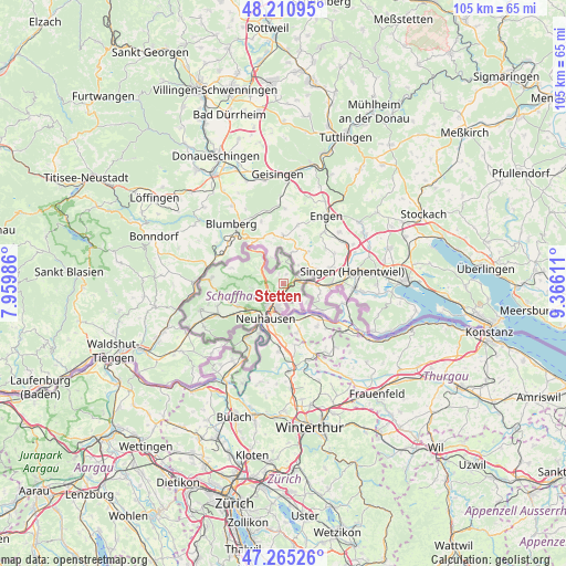
Stetten GPS coordinates[2]
47° 44' 24.9" North, 8° 39' 46.728" East
| Map corner | latitude | longitude |
|---|---|---|
| Upper-left | 48.21095°, | 7.95986° |
| Center: | 47.74025°, | 8.66298° |
| Lower-right: | 47.26526°, | 9.36611° |
| Map W x H: | 105.2×105.1 km | = 65.4×65.3mi |
| max Lat: | 47.76737° ⇑0.3% North |
| Stetten: | 47.74025° |
| min Lat: | ⇓99.7% South 45.83203° |
| min Long | Stetten | max Long |
| 5.97153° | 8.66298° | 10.44624° |
| W 71.2%⇐ | ⇒28.8% E |
Elevation
Elevation of Stetten is 573 m = 1880 ft, and this is 14.8 m = 49 ft above average elevation for this country.
| Max E: |
1845 m = 6053 ft | 29.7% |
| Stetten | 573 m 1880 ft | |
| Avg. | 558.2 m = 1831 ft | |
Min E: |
197 m = 646 ft | 70.3% |
See also: Switzerland elevation on elevation.city.
Geographical zone
Stetten is located in North temperate zone (between Tropic of Cancer and the Arctic Circle). Distance of this North polar circle is 2093 km =1300.5 mi to North.| Distance of | km | miles | from Stetten |
|---|---|---|---|
| North Pole | 4698.8 | 2919.7 | to North |
| Arctic Circle | 2093 | 1300.5 | to North |
| Tropic Cancer | 2702.3 | 1679.1 | to South |
| Equator | 5308.2 | 3298.4 | to South |


Nearby cities:
15 places around Stetten: (largest is in red/bold)
• Beringen
8.2 km =5.1 mi,  234°
234°
• Dachsen
9 km =5.6 mi,  201°
201°
• Diessenhofen
8.6 km =5.3 mi,  131°
131°
• Dörflingen
5.9 km =3.7 mi, 130°
• Feuerthalen
5.7 km =3.5 mi,  194°
194°
• Flurlingen
6.7 km =4.2 mi, 201°
• Hemmental
5.9 km =3.7 mi,  262°
262°
• Langwiesen
6.3 km =3.9 mi,  181°
181°
• Lohn
1.7 km =1.1 mi,  13°
13°
• Löhningen
9.3 km =5.8 mi,  242°
242°
• Merishausen
4.5 km =2.8 mi,  299°
299°
• Neuhausen
7 km =4.3 mi,  210°
210°
• Schaffhausen
5.2 km =3.2 mi, 203°
• Thayngen
3.4 km =2.1 mi,  76°
76°
• Uhwiesen
8 km =5 mi, 194°
Sources, notices
• [Note1] Compared only with cities in Switzerland existing in our database
• [Src1] Map data: © OpenStreetMap contributors (CC-BY-SA)
• [Src2] Other city data from geonames.org with taken over terms of usage.
• [Src3] Geographical zone / Annual Mean Temperature by Robert A. Rohde @ Wikipedia
