Gossau geodata
Gossau (Zurich) is a populated place; located in Switzerland in Europe/Zurich (GMT+2) time zone. With population of 4,287 people, there are 405 cities with bigger population in this country. Compared to other cities in Switzerland, 58.7% of cities are located further ↓South; 78.6% of cities are located further ←West and 52.4% of cities have higher elevation than Gossau. Note1


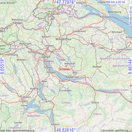
Gossau GPS coordinates[2]
47° 18' 18.36" North, 8° 45' 29.916" East
| Map corner | latitude | longitude |
|---|---|---|
| Upper-left | 47.77974°, | 8.05519° |
| Center: | 47.3051°, | 8.75831° |
| Lower-right: | 46.82616°, | 9.46144° |
| Map W x H: | 106×106 km | = 65.9×65.9mi |
| max Lat: | 47.76737° ⇑41.3% North |
| Gossau: | 47.3051° |
| min Lat: | ⇓58.7% South 45.83203° |
| min Long | Gossau | max Long |
| 5.97153° | 8.75831° | 10.44624° |
| W 78.6%⇐ | ⇒21.4% E |
Elevation
Elevation of Gossau is 473 m = 1552 ft, and this is 85.2 m = 280 ft below average elevation for this country.
| Max E: |
1845 m = 6053 ft | 52.4% |
| Avg. | 558.2 m = 1831 ft | |
| Gossau | 473 m = 1552 ft | |
Min E: |
197 m = 646 ft | 47.6% |
See also: Switzerland elevation on elevation.city.
Geographical zone
Gossau is located in North temperate zone (between Tropic of Cancer and the Arctic Circle). Distance of this North polar circle is 2141.3 km =1330.5 mi to North.| Distance of | km | miles | from Gossau |
|---|---|---|---|
| North Pole | 4747.2 | 2949.8 | to North |
| Arctic Circle | 2141.3 | 1330.5 | to North |
| Tropic Cancer | 2653.9 | 1649.1 | to South |
| Equator | 5259.8 | 3268.3 | to South |


Nearby cities:
15 places around Gossau: (largest is in red/bold)
• Bertschikon
1.7 km =1.1 mi,  358°
358°
• Binzikon
3.2 km =2 mi,  179°
179°
• Esslingen
4.4 km =2.7 mi,  236°
236°
• Grüt
2 km =1.2 mi,  69°
69°
• Mönchaltorf
2.9 km =1.8 mi,  279°
279°
• Mönchaltorf / Dorf
2.7 km =1.7 mi,  267°
267°
• Mönchaltorf / Hohfurren
3.2 km =2 mi,  290°
290°
• Oetwil / Zelgliacker
4.5 km =2.8 mi,  219°
219°
• Riedikon
4.5 km =2.8 mi,  310°
310°
• Uster / Nossikon
4.7 km =2.9 mi,  328°
328°
• Wetzikon
3.8 km =2.4 mi,  51°
51°
• Wetzikon / Ober-Wetzikon
3.9 km =2.4 mi, 54°
• Wetzikon / Robenhausen
3.6 km =2.2 mi,  37°
37°
• Wetzikon / Unter-Wetzikon
2.9 km =1.8 mi,  64°
64°
• Widum
3.6 km =2.2 mi, 44°
Sources, notices
• [Note1] Compared only with cities in Switzerland existing in our database
• [Src1] Map data: © OpenStreetMap contributors (CC-BY-SA)
• [Src2] Other city data from geonames.org with taken over terms of usage.
• [Src3] Geographical zone / Annual Mean Temperature by Robert A. Rohde @ Wikipedia
