Riedikon geodata
Riedikon (Zurich) is a populated place; located in Switzerland in Europe/Zurich (GMT+2) time zone. With population of 516 people, there are 1782 cities with bigger population in this country. Compared to other cities in Switzerland, 62.5% of cities are located further ↓South; 75.1% of cities are located further ←West and 69.1% of cities have higher elevation than Riedikon. Note1


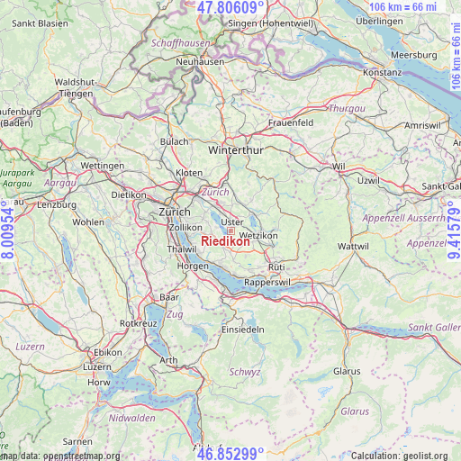
Riedikon GPS coordinates[2]
47° 19' 54.084" North, 8° 42' 45.576" East
| Map corner | latitude | longitude |
|---|---|---|
| Upper-left | 47.80609°, | 8.00954° |
| Center: | 47.33169°, | 8.71266° |
| Lower-right: | 46.85299°, | 9.41579° |
| Map W x H: | 106×106 km | = 65.9×65.9mi |
| max Lat: | 47.76737° ⇑37.5% North |
| Riedikon: | 47.33169° |
| min Lat: | ⇓62.5% South 45.83203° |
| min Long | Riedikon | max Long |
| 5.97153° | 8.71266° | 10.44624° |
| W 75.1%⇐ | ⇒24.9% E |
Elevation
Elevation of Riedikon is 440 m = 1444 ft, and this is 118.2 m = 388 ft below average elevation for this country.
| Max E: |
1845 m = 6053 ft | 69.1% |
| Avg. | 558.2 m = 1831 ft | |
| Riedikon | 440 m = 1444 ft | |
Min E: |
197 m = 646 ft | 30.9% |
See also: Switzerland elevation on elevation.city.
Geographical zone
Riedikon is located in North temperate zone (between Tropic of Cancer and the Arctic Circle). Distance of this North polar circle is 2138.4 km =1328.7 mi to North.| Distance of | km | miles | from Riedikon |
|---|---|---|---|
| North Pole | 4744.3 | 2948 | to North |
| Arctic Circle | 2138.4 | 1328.7 | to North |
| Tropic Cancer | 2656.9 | 1650.9 | to South |
| Equator | 5262.8 | 3270.2 | to South |


Nearby cities:
15 places around Riedikon: (largest is in red/bold)
• Bertschikon
3.6 km =2.2 mi,  110°
110°
• Egg
3.9 km =2.4 mi,  205°
205°
• Greifensee / Pfisterhölzli
4 km =2.5 mi,  334°
334°
• Hinteregg
3.5 km =2.2 mi,  219°
219°
• Mönchaltorf
2.5 km =1.6 mi,  166°
166°
• Mönchaltorf / Dorf
3.2 km =2 mi, 166°
• Mönchaltorf / Hohfurren
1.9 km =1.2 mi, 166°
• Scheuren
4.1 km =2.5 mi,  257°
257°
• Uster
1.8 km =1.1 mi,  19°
19°
• Uster / Gschwader
3.2 km =2 mi,  1°
1°
• Uster / Kirch-Uster
1.6 km =1 mi, 15°
• Uster / Nieder-Uster
2 km =1.2 mi, 333°
• Uster / Nossikon
1.4 km =0.9 mi,  43°
43°
• Uster / Ober-Uster
2.4 km =1.5 mi, 39°
• Wermatswil
4.2 km =2.6 mi,  31°
31°
Sources, notices
• [Note1] Compared only with cities in Switzerland existing in our database
• [Src1] Map data: © OpenStreetMap contributors (CC-BY-SA)
• [Src2] Other city data from geonames.org with taken over terms of usage.
• [Src3] Geographical zone / Annual Mean Temperature by Robert A. Rohde @ Wikipedia
