Fraubrunnen geodata
Fraubrunnen (Bern) is a populated place; located in Switzerland in Europe/Zurich (GMT+2) time zone. With population of 1,616 people, there are 973 cities with bigger population in this country. Compared to other cities in Switzerland, 59.5% of cities are located further ↑North; 74.7% of cities are located further →East and 54.8% of cities have lower elevation than Fraubrunnen. Note1


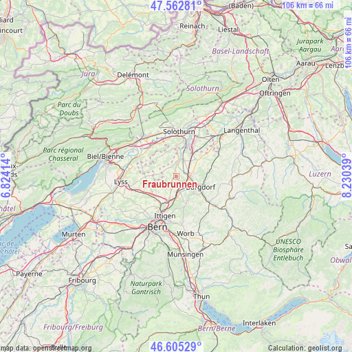
Fraubrunnen GPS coordinates[2]
47° 5' 10.32" North, 7° 31' 38.172" East
| Map corner | latitude | longitude |
|---|---|---|
| Upper-left | 47.56281°, | 6.82414° |
| Center: | 47.0862°, | 7.52727° |
| Lower-right: | 46.60529°, | 8.23039° |
| Map W x H: | 106.5×106.5 km | = 66.2×66.2mi |
| max Lat: | 47.76737° ⇑59.5% North |
| Fraubrunnen: | 47.0862° |
| min Lat: | ⇓40.5% South 45.83203° |
| min Long | Fraubrunnen | max Long |
| 5.97153° | 7.52727° | 10.44624° |
| W 25.3%⇐ | ⇒74.7% E |
Elevation
Elevation of Fraubrunnen is 495 m = 1624 ft, and this is 63.2 m = 207 ft below average elevation for this country.
| Max E: |
1845 m = 6053 ft | 45.2% |
| Avg. | 558.2 m = 1831 ft | |
| Fraubrunnen | 495 m = 1624 ft | |
Min E: |
197 m = 646 ft | 54.8% |
See also: Switzerland elevation on elevation.city.
Geographical zone
Fraubrunnen is located in North temperate zone (between Tropic of Cancer and the Arctic Circle). Distance of this North polar circle is 2165.7 km =1345.7 mi to North.| Distance of | km | miles | from Fraubrunnen |
|---|---|---|---|
| North Pole | 4771.6 | 2964.9 | to North |
| Arctic Circle | 2165.7 | 1345.7 | to North |
| Tropic Cancer | 2629.6 | 1634 | to South |
| Equator | 5235.5 | 3253.2 | to South |


Nearby cities:
15 places around Fraubrunnen: (largest is in red/bold)
• Burgdorf
8.2 km =5.1 mi,  111°
111°
• Bäriswil
7.4 km =4.6 mi,  180°
180°
• Bätterkinden
5.1 km =3.2 mi,  9°
9°
• Ersigen
5.2 km =3.2 mi,  80°
80°
• Hindelbank
5 km =3.1 mi,  167°
167°
• Jegenstorf
4.5 km =2.8 mi,  199°
199°
• Kirchberg
4.2 km =2.6 mi,  91°
91°
• Koppigen
7.7 km =4.8 mi,  49°
49°
• Krauchthal
9 km =5.6 mi,  160°
160°
• Lyssach
4.8 km =3 mi,  120°
120°
• Messen
6.2 km =3.9 mi,  275°
275°
• Münchenbuchsee
9.2 km =5.7 mi,  219°
219°
• Rüti bei Lyssach
5 km =3.1 mi,  131°
131°
• Urtenen
6.9 km =4.3 mi, 196°
• Utzenstorf
5.5 km =3.4 mi,  21°
21°
Sources, notices
• [Note1] Compared only with cities in Switzerland existing in our database
• [Src1] Map data: © OpenStreetMap contributors (CC-BY-SA)
• [Src2] Other city data from geonames.org with taken over terms of usage.
• [Src3] Geographical zone / Annual Mean Temperature by Robert A. Rohde @ Wikipedia
