Eschenbach geodata
Eschenbach (Saint Gallen) is a populated place; located in Switzerland in Europe/Zurich (GMT+2) time zone. With population of 9,175 people, there are 174 cities with bigger population in this country. Compared to other cities in Switzerland, 50.8% of cities are located further ↓South; 85.3% of cities are located further ←West and 51.1% of cities have lower elevation than Eschenbach. Note1
Administrative division(s):
- Level 1: Saint Gallen
- Level 2: Wahlkreis See-Gaster
- Level 3: Eschenbach (SG)


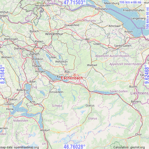
Eschenbach GPS coordinates[2]
47° 14' 23.316" North, 8° 55' 17.616" East
| Map corner | latitude | longitude |
|---|---|---|
| Upper-left | 47.71503°, | 8.21843° |
| Center: | 47.23981°, | 8.92156° |
| Lower-right: | 46.76028°, | 9.62468° |
| Map W x H: | 106.2×106.2 km | = 66×66mi |
| max Lat: | 47.76737° ⇑49.2% North |
| Eschenbach: | 47.23981° |
| min Lat: | ⇓50.8% South 45.83203° |
| min Long | Eschenbach | max Long |
| 5.97153° | 8.92156° | 10.44624° |
| W 85.3%⇐ | ⇒14.7% E |
Elevation
Elevation of Eschenbach is 480 m = 1575 ft, and this is 78.2 m = 257 ft below average elevation for this country.
| Max E: |
1845 m = 6053 ft | 48.9% |
| Avg. | 558.2 m = 1831 ft | |
| Eschenbach | 480 m = 1575 ft | |
Min E: |
197 m = 646 ft | 51.1% |
See also: Switzerland elevation on elevation.city.
Geographical zone
Eschenbach is located in North temperate zone (between Tropic of Cancer and the Arctic Circle). Distance of this North polar circle is 2148.6 km =1335.1 mi to North.| Distance of | km | miles | from Eschenbach |
|---|---|---|---|
| North Pole | 4754.5 | 2954.3 | to North |
| Arctic Circle | 2148.6 | 1335.1 | to North |
| Tropic Cancer | 2646.7 | 1644.6 | to South |
| Equator | 5252.6 | 3263.8 | to South |


Nearby cities:
15 places around Eschenbach: (largest is in red/bold)
• Breitenmatt
5.4 km =3.4 mi,  319°
319°
• Goldingen
4.1 km =2.5 mi,  47°
47°
• Jona
6.3 km =3.9 mi,  259°
259°
• Laupen
2.8 km =1.7 mi,  10°
10°
• Pilgerhof
5 km =3.1 mi,  305°
305°
• Rüti
5.3 km =3.3 mi,  289°
289°
• Rüti / Dorfzentrum, Südl. Teil
5.1 km =3.2 mi, 287°
• Rüti / Oberdorf
4.8 km =3 mi,  296°
296°
• Rüti / Westlicher Dorfteil
6 km =3.7 mi, 286°
• Sankt Gallenkappel
3.3 km =2.1 mi,  82°
82°
• Schmerikon
2.6 km =1.6 mi,  128°
128°
• Tann / Tann (Dorfkern)
6 km =3.7 mi, 297°
• Tuggen
4.6 km =2.9 mi,  153°
153°
• Uznach
4.9 km =3 mi,  110°
110°
• Wald
4.1 km =2.5 mi,  351°
351°
Sources, notices
• [Note1] Compared only with cities in Switzerland existing in our database
• [Src1] Map data: © OpenStreetMap contributors (CC-BY-SA)
• [Src2] Other city data from geonames.org with taken over terms of usage.
• [Src3] Geographical zone / Annual Mean Temperature by Robert A. Rohde @ Wikipedia
