Goldingen geodata
Goldingen (Saint Gallen) is a populated place; located in Switzerland in Europe/Zurich (GMT+2) time zone. With population of 1,013 people, there are 1316 cities with bigger population in this country. Compared to other cities in Switzerland, 53.5% of cities are located further ↓South; 86.5% of cities are located further ←West and 86.1% of cities have lower elevation than Goldingen. Note1
Administrative division(s):
- Level 1: Saint Gallen
- Level 2: Wahlkreis See-Gaster
- Level 3: Eschenbach (SG)


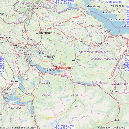
Goldingen GPS coordinates[2]
47° 15' 53.172" North, 8° 57' 42.012" East
| Map corner | latitude | longitude |
|---|---|---|
| Upper-left | 47.73977°, | 8.25855° |
| Center: | 47.26477°, | 8.96167° |
| Lower-right: | 46.78547°, | 9.6648° |
| Map W x H: | 106.1×106.1 km | = 65.9×65.9mi |
| max Lat: | 47.76737° ⇑46.5% North |
| Goldingen: | 47.26477° |
| min Lat: | ⇓53.5% South 45.83203° |
| min Long | Goldingen | max Long |
| 5.97153° | 8.96167° | 10.44624° |
| W 86.5%⇐ | ⇒13.5% E |
Elevation
Elevation of Goldingen is 752 m = 2467 ft, and this is 193.8 m = 636 ft above average elevation for this country.
| Max E: |
1845 m = 6053 ft | 13.9% |
| Goldingen | 752 m 2467 ft | |
| Avg. | 558.2 m = 1831 ft | |
Min E: |
197 m = 646 ft | 86.1% |
See also: Switzerland elevation on elevation.city.
Geographical zone
Goldingen is located in North temperate zone (between Tropic of Cancer and the Arctic Circle). Distance of this North polar circle is 2145.8 km =1333.3 mi to North.| Distance of | km | miles | from Goldingen |
|---|---|---|---|
| North Pole | 4751.7 | 2952.6 | to North |
| Arctic Circle | 2145.8 | 1333.3 | to North |
| Tropic Cancer | 2649.4 | 1646.3 | to South |
| Equator | 5255.3 | 3265.5 | to South |


Nearby cities:
15 places around Goldingen: (largest is in red/bold)
• Benken
8 km =5 mi,  154°
154°
• Breitenmatt
6.7 km =4.2 mi,  281°
281°
• Eschenbach
4.1 km =2.5 mi,  227°
227°
• Gommiswald
6 km =3.7 mi,  128°
128°
• Kaltbrunn
7.5 km =4.7 mi,  139°
139°
• Laupen
2.5 km =1.6 mi,  270°
270°
• Oberdürnten
7.7 km =4.8 mi, 282°
• Pilgerhof
7.1 km =4.4 mi, 271°
• Rüti / Dorfzentrum, Südl. Teil
8 km =5 mi,  261°
261°
• Rüti / Oberdorf
7.3 km =4.5 mi, 264°
• Sankt Gallenkappel
2.4 km =1.5 mi,  175°
175°
• Schmerikon
4.5 km =2.8 mi,  192°
192°
• Tuggen
6.9 km =4.3 mi, 187°
• Uznach
4.8 km =3 mi,  160°
160°
• Wald
3.8 km =2.4 mi,  289°
289°
Sources, notices
• [Note1] Compared only with cities in Switzerland existing in our database
• [Src1] Map data: © OpenStreetMap contributors (CC-BY-SA)
• [Src2] Other city data from geonames.org with taken over terms of usage.
• [Src3] Geographical zone / Annual Mean Temperature by Robert A. Rohde @ Wikipedia
