Cossonay geodata
Cossonay (Vaud) is a populated place; located in Switzerland in Europe/Zurich (GMT+2) time zone. With population of 2,795 people, there are 632 cities with bigger population in this country. Compared to other cities in Switzerland, 81.8% of cities are located further ↑North; 95.3% of cities are located further →East and 68.6% of cities have lower elevation than Cossonay. Note1


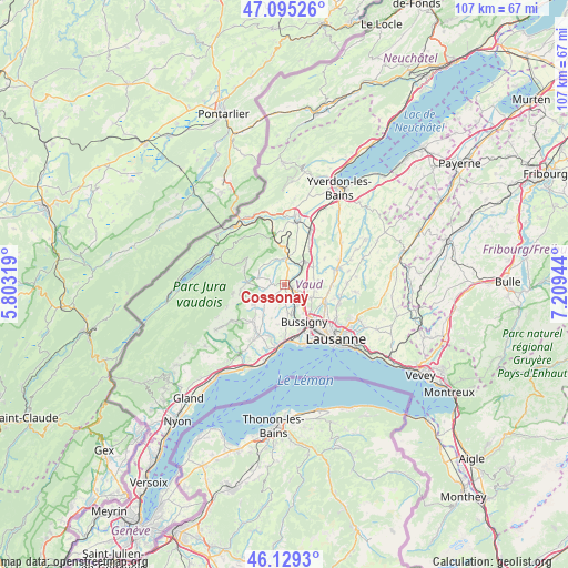
Cossonay GPS coordinates[2]
46° 36' 51.948" North, 6° 30' 22.716" East
| Map corner | latitude | longitude |
|---|---|---|
| Upper-left | 47.09526°, | 5.80319° |
| Center: | 46.61443°, | 6.50631° |
| Lower-right: | 46.1293°, | 7.20944° |
| Map W x H: | 107.4×107.4 km | = 66.7×66.7mi |
| max Lat: | 47.76737° ⇑81.8% North |
| Cossonay: | 46.61443° |
| min Lat: | ⇓18.2% South 45.83203° |
| min Long | Cossonay | max Long |
| 5.97153° | 6.50631° | 10.44624° |
| W 4.7%⇐ | ⇒95.3% E |
Elevation
Elevation of Cossonay is 565 m = 1854 ft, and this is 6.8 m = 22 ft above average elevation for this country.
| Max E: |
1845 m = 6053 ft | 31.4% |
| Cossonay | 565 m 1854 ft | |
| Avg. | 558.2 m = 1831 ft | |
Min E: |
197 m = 646 ft | 68.6% |
See also: Switzerland elevation on elevation.city.
Geographical zone
Cossonay is located in North temperate zone (between Tropic of Cancer and the Arctic Circle). Distance of this North polar circle is 2218.1 km =1378.3 mi to North.| Distance of | km | miles | from Cossonay |
|---|---|---|---|
| North Pole | 4824 | 2997.5 | to North |
| Arctic Circle | 2218.1 | 1378.3 | to North |
| Tropic Cancer | 2577.1 | 1601.3 | to South |
| Equator | 5183 | 3220.6 | to South |


Nearby cities:
15 places around Cossonay: (largest is in red/bold)
• Chavannes-le-Veyron
4.3 km =2.7 mi,  258°
258°
• Chevilly
3.9 km =2.4 mi,  324°
324°
• Colombier
6.9 km =4.3 mi,  201°
201°
• Cuarnens
5.4 km =3.4 mi,  283°
283°
• Daillens
3.3 km =2.1 mi,  77°
77°
• Ferreyres
5.1 km =3.2 mi,  341°
341°
• Gollion
3.3 km =2.1 mi,  175°
175°
• Grancy
4.1 km =2.5 mi,  232°
232°
• La Chaux
2.6 km =1.6 mi, 276°
• La Sarraz
4.9 km =3 mi,  3°
3°
• Mauraz
6.6 km =4.1 mi, 261°
• Moiry
5.6 km =3.5 mi,  313°
313°
• Orny
6.1 km =3.8 mi,  14°
14°
• Penthalaz
1.5 km =0.9 mi,  105°
105°
• Pompaples
5.8 km =3.6 mi, 2°
Sources, notices
• [Note1] Compared only with cities in Switzerland existing in our database
• [Src1] Map data: © OpenStreetMap contributors (CC-BY-SA)
• [Src2] Other city data from geonames.org with taken over terms of usage.
• [Src3] Geographical zone / Annual Mean Temperature by Robert A. Rohde @ Wikipedia
