Chevilly geodata
Chevilly (Vaud) is a seat of a third-order administrative division; located in Switzerland in Europe/Zurich (GMT+2) time zone. In our database, there are 1823 cities with bigger population. Compared to other cities in Switzerland, 80.7% of cities are located further ↑North; 95.7% of cities are located further →East and 70.9% of cities have lower elevation than Chevilly. Note1


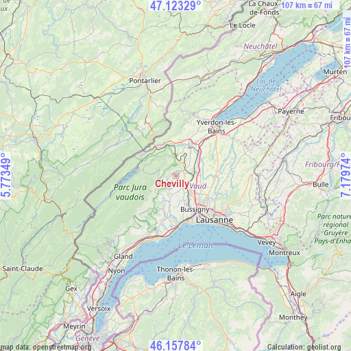
Chevilly GPS coordinates[2]
46° 38' 33.792" North, 6° 28' 35.796" East
| Map corner | latitude | longitude |
|---|---|---|
| Upper-left | 47.12329°, | 5.77349° |
| Center: | 46.64272°, | 6.47661° |
| Lower-right: | 46.15784°, | 7.17974° |
| Map W x H: | 107.3×107.3 km | = 66.7×66.7mi |
| max Lat: | 47.76737° ⇑80.7% North |
| Chevilly: | 46.64272° |
| min Lat: | ⇓19.3% South 45.83203° |
| min Long | Chevilly | max Long |
| 5.97153° | 6.47661° | 10.44624° |
| W 4.3%⇐ | ⇒95.7% E |
Elevation
Elevation of Chevilly is 578 m = 1896 ft, and this is 19.8 m = 65 ft above average elevation for this country.
| Max E: |
1845 m = 6053 ft | 29.1% |
| Chevilly | 578 m 1896 ft | |
| Avg. | 558.2 m = 1831 ft | |
Min E: |
197 m = 646 ft | 70.9% |
See also: Switzerland elevation on elevation.city.
Geographical zone
Chevilly is located in North temperate zone (between Tropic of Cancer and the Arctic Circle). Distance of this North polar circle is 2215 km =1376.3 mi to North.| Distance of | km | miles | from Chevilly |
|---|---|---|---|
| North Pole | 4820.9 | 2995.6 | to North |
| Arctic Circle | 2215 | 1376.3 | to North |
| Tropic Cancer | 2580.3 | 1603.3 | to South |
| Equator | 5186.2 | 3222.6 | to South |


Nearby cities:
15 places around Chevilly: (largest is in red/bold)
• Chavannes-le-Veyron
4.4 km =2.7 mi,  206°
206°
• Cossonay
3.9 km =2.4 mi,  144°
144°
• Cuarnens
3.6 km =2.2 mi,  237°
237°
• Daillens
6 km =3.7 mi,  113°
113°
• Ferreyres
1.8 km =1.1 mi,  21°
21°
• Gollion
6.9 km =4.3 mi,  158°
158°
• Grancy
5.7 km =3.5 mi,  189°
189°
• La Chaux
2.9 km =1.8 mi, 186°
• La Sarraz
3.2 km =2 mi,  55°
55°
• Mauraz
5.9 km =3.7 mi,  225°
225°
• Moiry
1.9 km =1.2 mi,  291°
291°
• Orny
4.7 km =2.9 mi,  53°
53°
• Pampigny
7.8 km =4.8 mi, 207°
• Penthalaz
5.1 km =3.2 mi,  133°
133°
• Pompaples
3.7 km =2.3 mi,  43°
43°
Sources, notices
• [Note1] Compared only with cities in Switzerland existing in our database
• [Src1] Map data: © OpenStreetMap contributors (CC-BY-SA)
• [Src2] Other city data from geonames.org with taken over terms of usage.
• [Src3] Geographical zone / Annual Mean Temperature by Robert A. Rohde @ Wikipedia
