Buchberg geodata
Buchberg (Schaffhausen) is a populated place; located in Switzerland in Europe/Zurich (GMT+2) time zone. With population of 781 people, there are 1506 cities with bigger population in this country. Compared to other cities in Switzerland, 96.1% of cities are located further ↓South; 62.6% of cities are located further ←West and 52.1% of cities have lower elevation than Buchberg. Note1


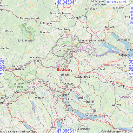
Buchberg GPS coordinates[2]
47° 34' 22.152" North, 8° 33' 46.116" East
| Map corner | latitude | longitude |
|---|---|---|
| Upper-left | 48.04504°, | 7.85969° |
| Center: | 47.57282°, | 8.56281° |
| Lower-right: | 47.09631°, | 9.26594° |
| Map W x H: | 105.5×105.5 km | = 65.6×65.6mi |
| max Lat: | 47.76737° ⇑3.9% North |
| Buchberg: | 47.57282° |
| min Lat: | ⇓96.1% South 45.83203° |
| min Long | Buchberg | max Long |
| 5.97153° | 8.56281° | 10.44624° |
| W 62.6%⇐ | ⇒37.4% E |
Elevation
Elevation of Buchberg is 485 m = 1591 ft, and this is 73.2 m = 240 ft below average elevation for this country.
| Max E: |
1845 m = 6053 ft | 47.9% |
| Avg. | 558.2 m = 1831 ft | |
| Buchberg | 485 m = 1591 ft | |
Min E: |
197 m = 646 ft | 52.1% |
See also: Switzerland elevation on elevation.city.
Geographical zone
Buchberg is located in North temperate zone (between Tropic of Cancer and the Arctic Circle). Distance of this North polar circle is 2111.6 km =1312.1 mi to North.| Distance of | km | miles | from Buchberg |
|---|---|---|---|
| North Pole | 4717.5 | 2931.3 | to North |
| Arctic Circle | 2111.6 | 1312.1 | to North |
| Tropic Cancer | 2683.7 | 1667.6 | to South |
| Equator | 5289.6 | 3286.8 | to South |


Nearby cities:
15 places around Buchberg: (largest is in red/bold)
• Bülach
5.9 km =3.7 mi,  196°
196°
• Bülach / Chröpfli
5.1 km =3.2 mi,  193°
193°
• Bülach / Gstückt
5.6 km =3.5 mi, 190°
• Bülach / Seematt
6.3 km =3.9 mi, 191°
• Bülach / Soligänter
5.4 km =3.4 mi, 197°
• Eglisau
3.2 km =2 mi,  279°
279°
• Flaach
3.3 km =2.1 mi,  83°
83°
• Freienstein
4.7 km =2.9 mi,  159°
159°
• Glattfelden
4.8 km =3 mi,  251°
251°
• Hüntwangen
5.9 km =3.7 mi,  295°
295°
• Rafz
3.8 km =2.4 mi,  337°
337°
• Rorbas
4.8 km =3 mi,  168°
168°
• Seglingen
3.1 km =1.9 mi,  269°
269°
• Seglingen / Ober-Seglingen
2.7 km =1.7 mi, 268°
• Wil
5.4 km =3.4 mi,  310°
310°
Sources, notices
• [Note1] Compared only with cities in Switzerland existing in our database
• [Src1] Map data: © OpenStreetMap contributors (CC-BY-SA)
• [Src2] Other city data from geonames.org with taken over terms of usage.
• [Src3] Geographical zone / Annual Mean Temperature by Robert A. Rohde @ Wikipedia
