Seglingen / Ober-Seglingen geodata
Seglingen / Ober-Seglingen (Zurich) is a section of populated place; located in Switzerland in Europe/Zurich (GMT+2) time zone. With population of 503 people, there are 1805 cities with bigger population in this country. Compared to other cities in Switzerland, 96% of cities are located further ↓South; 59.4% of cities are located further ←West and 92.2% of cities have higher elevation than Seglingen / Ober-Seglingen. Note1
Current local time in Seglingen / Ober-Seglingen:
07:36 AM, SaturdayDifference from your time zone: hours


Seglingen / Ober-Seglingen GPS coordinates[2]
47° 34' 19.236" North, 8° 31' 37.02" East
| Map corner | latitude | longitude |
|---|---|---|
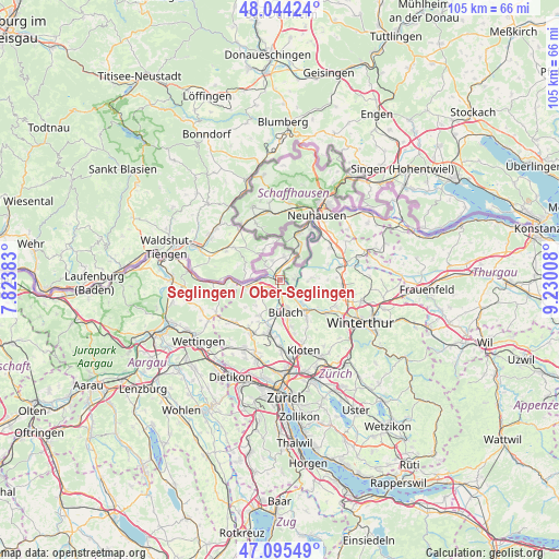
| Upper-left | 48.04424°, | 7.82383° |
| Center: | 47.57201°, | 8.52695° |
| Lower-right: | 47.09549°, | 9.23008° |
| Map W x H: | 105.5×105.5 km | = 65.6×65.6mi |
| max Lat: | 47.76737° ⇑4% North |
| Seglingen / Ober-Seglingen: | 47.57201° |
| min Lat: | ⇓96% South 45.83203° |
| min Long | Seglingen / Obe | max Long |
| 5.97153° | 8.52695° | 10.44624° |
| W 59.4%⇐ | ⇒40.6% E |
Elevation
Elevation of Seglingen / Ober-Seglingen is 385 m = 1263 ft, and this is 173.2 m = 568 ft below average elevation for this country.
| Max E: |
1845 m = 6053 ft | 92.2% |
| Avg. | 558.2 m = 1831 ft | |
| Seglingen / Ober-Seglingen | 385 m = 1263 ft | |
Min E: |
197 m = 646 ft | 7.8% |
See also: Switzerland elevation on elevation.city.
Geographical zone
Seglingen / Ober-Seglingen is located in North temperate zone (between Tropic of Cancer and the Arctic Circle). Distance of this North polar circle is 2111.7 km =1312.1 mi to North.| Distance of | km | miles | from Seglingen / Ober-Seglingen |
|---|---|---|---|
| North Pole | 4717.6 | 2931.4 | to North |
| Arctic Circle | 2111.7 | 1312.1 | to North |
| Tropic Cancer | 2683.6 | 1667.5 | to South |
| Equator | 5289.5 | 3286.7 | to South |


Nearby cities:
15 places around Seglingen / Ober-Seglingen: (largest is in red/bold)
• Buchberg
2.7 km =1.7 mi,  88°
88°
• Bülach
5.7 km =3.5 mi,  169°
169°
• Bülach / Chröpfli
5.1 km =3.2 mi,  162°
162°
• Bülach / Grossstein
5.8 km =3.6 mi,  176°
176°
• Bülach / Gstückt
5.7 km =3.5 mi, 163°
• Bülach / Soligänter
5.2 km =3.2 mi, 168°
• Eglisau
0.7 km =0.4 mi,  324°
324°
• Glattfelden
2.4 km =1.5 mi,  232°
232°
• Hochfelden
5.6 km =3.5 mi,  188°
188°
• Hüntwangen
3.8 km =2.4 mi,  314°
314°
• Rafz
3.8 km =2.4 mi,  18°
18°
• Rorbas
5.8 km =3.6 mi,  141°
141°
• Seglingen
0.5 km =0.3 mi,  276°
276°
• Wasterkingen
4.6 km =2.9 mi,  295°
295°
• Wil
3.9 km =2.4 mi,  338°
338°
Sources, notices
• [Note1] Compared only with cities in Switzerland existing in our database
• [Src1] Map data: © OpenStreetMap contributors (CC-BY-SA)
• [Src2] Other city data from geonames.org with taken over terms of usage.
• [Src3] Geographical zone / Annual Mean Temperature by Robert A. Rohde @ Wikipedia
