Baden geodata
Baden (Aargau) is a seat of a second-order administrative division; located in Switzerland in Europe/Zurich (GMT+2) time zone. With population of 16,118 people, there are 68 cities with bigger population in this country. Compared to other cities in Switzerland, 85.3% of cities are located further ↓South; 53% of cities are located further →East and 81.7% of cities have higher elevation than Baden. Note1


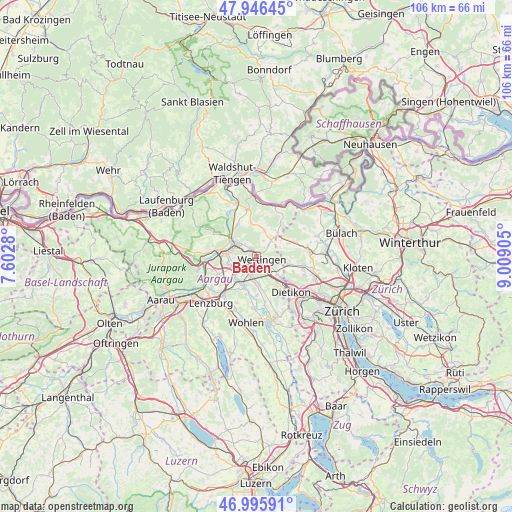
Baden GPS coordinates[2]
47° 28' 23.988" North, 8° 18' 21.312" East
| Map corner | latitude | longitude |
|---|---|---|
| Upper-left | 47.94645°, | 7.6028° |
| Center: | 47.47333°, | 8.30592° |
| Lower-right: | 46.99591°, | 9.00905° |
| Map W x H: | 105.7×105.7 km | = 65.7×65.7mi |
| max Lat: | 47.76737° ⇑14.7% North |
| Baden: | 47.47333° |
| min Lat: | ⇓85.3% South 45.83203° |
| min Long | Baden | max Long |
| 5.97153° | 8.30592° | 10.44624° |
| W 47%⇐ | ⇒53% E |
Elevation
Elevation of Baden is 418 m = 1371 ft, and this is 140.2 m = 460 ft below average elevation for this country.
| Max E: |
1845 m = 6053 ft | 81.7% |
| Avg. | 558.2 m = 1831 ft | |
| Baden | 418 m = 1371 ft | |
Min E: |
197 m = 646 ft | 18.3% |
See also: Switzerland elevation on elevation.city.
Geographical zone
Baden is located in North temperate zone (between Tropic of Cancer and the Arctic Circle). Distance of this North polar circle is 2122.6 km =1318.9 mi to North.| Distance of | km | miles | from Baden |
|---|---|---|---|
| North Pole | 4728.5 | 2938.2 | to North |
| Arctic Circle | 2122.6 | 1318.9 | to North |
| Tropic Cancer | 2672.6 | 1660.7 | to South |
| Equator | 5278.5 | 3279.9 | to South |


Nearby cities:
15 places around Baden: (largest is in red/bold)
• Birmenstorf
4.5 km =2.8 mi,  253°
253°
• Ehrendingen
4.5 km =2.8 mi,  43°
43°
• Gebenstorf
5.1 km =3.2 mi,  280°
280°
• Killwangen
5.7 km =3.5 mi,  143°
143°
• Lauffohr (Brugg)
6.4 km =4 mi,  299°
299°
• Mellingen
6.5 km =4 mi,  202°
202°
• Neuenhof
3 km =1.9 mi,  148°
148°
• Niederrohrdorf
5.5 km =3.4 mi,  181°
181°
• Niederweningen / Niederweningen (Dorf)
6.5 km =4 mi,  55°
55°
• Oberrohrdorf
6.2 km =3.9 mi,  170°
170°
• Obersiggenthal
1.7 km =1.1 mi,  335°
335°
• Turgi
4.4 km =2.7 mi, 298°
• Untersiggenthal
5 km =3.1 mi,  310°
310°
• Wettingen
0.8 km =0.5 mi,  111°
111°
• Würenlos
5.5 km =3.4 mi,  129°
129°
Sources, notices
• [Note1] Compared only with cities in Switzerland existing in our database
• [Src1] Map data: © OpenStreetMap contributors (CC-BY-SA)
• [Src2] Other city data from geonames.org with taken over terms of usage.
• [Src3] Geographical zone / Annual Mean Temperature by Robert A. Rohde @ Wikipedia
