Meinisberg geodata
Meinisberg (Bern) is a populated place; located in Switzerland in Europe/Zurich (GMT+2) time zone. With population of 1,198 people, there are 1202 cities with bigger population in this country. Compared to other cities in Switzerland, 55.6% of cities are located further ↑North; 78.8% of cities are located further →East and 65.3% of cities have higher elevation than Meinisberg. Note1


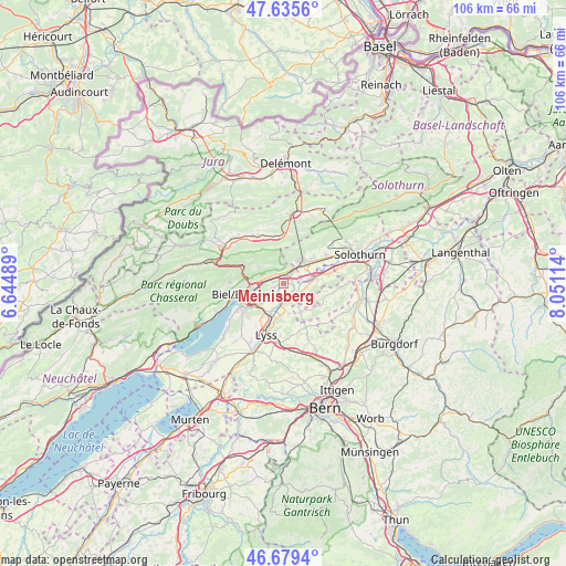
Meinisberg GPS coordinates[2]
47° 9' 34.74" North, 7° 20' 52.836" East
| Map corner | latitude | longitude |
|---|---|---|
| Upper-left | 47.6356°, | 6.64489° |
| Center: | 47.15965°, | 7.34801° |
| Lower-right: | 46.6794°, | 8.05114° |
| Map W x H: | 106.3×106.3 km | = 66.1×66.1mi |
| max Lat: | 47.76737° ⇑55.6% North |
| Meinisberg: | 47.15965° |
| min Lat: | ⇓44.4% South 45.83203° |
| min Long | Meinisberg | max Long |
| 5.97153° | 7.34801° | 10.44624° |
| W 21.2%⇐ | ⇒78.8% E |
Elevation
Elevation of Meinisberg is 446 m = 1463 ft, and this is 112.2 m = 368 ft below average elevation for this country.
| Max E: |
1845 m = 6053 ft | 65.3% |
| Avg. | 558.2 m = 1831 ft | |
| Meinisberg | 446 m = 1463 ft | |
Min E: |
197 m = 646 ft | 34.7% |
See also: Switzerland elevation on elevation.city.
Geographical zone
Meinisberg is located in North temperate zone (between Tropic of Cancer and the Arctic Circle). Distance of this North polar circle is 2157.5 km =1340.6 mi to North.| Distance of | km | miles | from Meinisberg |
|---|---|---|---|
| North Pole | 4763.4 | 2959.8 | to North |
| Arctic Circle | 2157.5 | 1340.6 | to North |
| Tropic Cancer | 2637.7 | 1639 | to South |
| Equator | 5243.7 | 3258.3 | to South |


Nearby cities:
15 places around Meinisberg: (largest is in red/bold)
• Arch
6.3 km =3.9 mi,  84°
84°
• Bettlach
7.3 km =4.5 mi,  51°
51°
• Biel/Bienne
8.1 km =5 mi,  252°
252°
• Brügg
6.6 km =4.1 mi,  232°
232°
• Büren an der Aare
2.8 km =1.7 mi,  140°
140°
• Court
8.9 km =5.5 mi,  354°
354°
• Evilard
8.3 km =5.2 mi,  262°
262°
• Grenchen
5.1 km =3.2 mi, 45°
• Lengnau
2.9 km =1.8 mi,  32°
32°
• Leuzigen
8.5 km =5.3 mi, 78°
• Orpund
3.8 km =2.4 mi, 232°
• Pieterlen
1.9 km =1.2 mi,  335°
335°
• Péry
8.4 km =5.2 mi,  297°
297°
• Schnottwil
6.4 km =4 mi,  147°
147°
• Worben
7.5 km =4.7 mi,  212°
212°
Sources, notices
• [Note1] Compared only with cities in Switzerland existing in our database
• [Src1] Map data: © OpenStreetMap contributors (CC-BY-SA)
• [Src2] Other city data from geonames.org with taken over terms of usage.
• [Src3] Geographical zone / Annual Mean Temperature by Robert A. Rohde @ Wikipedia
