Au geodata
Au (Zurich) is a populated locality; located in Switzerland in Europe/Zurich (GMT+2) time zone. With population of 4,844 people, there are 359 cities with bigger population in this country. Compared to other cities in Switzerland, 50.9% of cities are located further ↓South; 69.8% of cities are located further ←West and 50.2% of cities have lower elevation than Au. Note1


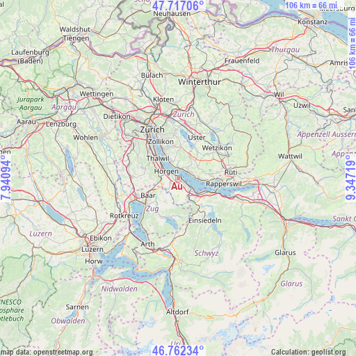
Au GPS coordinates[2]
47° 14' 30.66" North, 8° 38' 38.616" East
| Map corner | latitude | longitude |
|---|---|---|
| Upper-left | 47.71706°, | 7.94094° |
| Center: | 47.24185°, | 8.64406° |
| Lower-right: | 46.76234°, | 9.34719° |
| Map W x H: | 106.2×106.2 km | = 66×66mi |
| max Lat: | 47.76737° ⇑49.1% North |
| Au: | 47.24185° |
| min Lat: | ⇓50.9% South 45.83203° |
| min Long | Au | max Long |
| 5.97153° | 8.64406° | 10.44624° |
| W 69.8%⇐ | ⇒30.2% E |
Elevation
Elevation of Au is 478 m = 1568 ft, and this is 80.2 m = 263 ft below average elevation for this country.
| Max E: |
1845 m = 6053 ft | 49.8% |
| Avg. | 558.2 m = 1831 ft | |
| Au | 478 m = 1568 ft | |
Min E: |
197 m = 646 ft | 50.2% |
See also: Switzerland elevation on elevation.city.
Geographical zone
Au is located in North temperate zone (between Tropic of Cancer and the Arctic Circle). Distance of this North polar circle is 2148.4 km =1335 mi to North.| Distance of | km | miles | from Au |
|---|---|---|---|
| North Pole | 4754.3 | 2954.2 | to North |
| Arctic Circle | 2148.4 | 1335 | to North |
| Tropic Cancer | 2646.9 | 1644.7 | to South |
| Equator | 5252.8 | 3263.9 | to South |


Nearby cities:
15 places around Au: (largest is in red/bold)
• Au / Mittel-Dorf
0.2 km =0.1 mi,  46°
46°
• Au / Ober-Ort/Gwad
1 km =0.6 mi,  104°
104°
• Au / Unter-Dorf
1.1 km =0.7 mi,  305°
305°
• Horgen / Allmend
2.9 km =1.8 mi,  282°
282°
• Horgen / Käpfnach
2.7 km =1.7 mi,  301°
301°
• Meilen
3.4 km =2.1 mi,  2°
2°
• Meilen / Halten
3.3 km =2.1 mi,  16°
16°
• Obermeilen
2.8 km =1.7 mi, 18°
• Wädenswil
2.5 km =1.6 mi,  131°
131°
• Wädenswil / Büelen
1.7 km =1.1 mi,  120°
120°
• Wädenswil / Dorf (Wädenswil)
2.5 km =1.6 mi, 123°
• Wädenswil / Eichweid
3.5 km =2.2 mi,  138°
138°
• Wädenswil / Hangenmoos
1.1 km =0.7 mi, 144°
• Wädenswil / Leihof-Mühlebach
2.9 km =1.8 mi, 134°
• Wädenswil / Untermosen-Fuhr
2.1 km =1.3 mi, 137°
Sources, notices
• [Note1] Compared only with cities in Switzerland existing in our database
• [Src1] Map data: © OpenStreetMap contributors (CC-BY-SA)
• [Src2] Other city data from geonames.org with taken over terms of usage.
• [Src3] Geographical zone / Annual Mean Temperature by Robert A. Rohde @ Wikipedia
