Au / Ober-Ort/Gwad geodata
Au / Ober-Ort/Gwad (Zurich) is a section of populated place; located in Switzerland in Europe/Zurich (GMT+2) time zone. With population of 979 people, there are 1343 cities with bigger population in this country. Compared to other cities in Switzerland, 50.6% of cities are located further ↓South; 71% of cities are located further ←West and 84% of cities have higher elevation than Au / Ober-Ort/Gwad. Note1


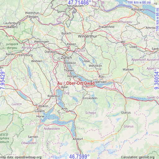
Au / Ober-Ort/Gwad GPS coordinates[2]
47° 14' 21.948" North, 8° 39' 26.676" East
| Map corner | latitude | longitude |
|---|---|---|
| Upper-left | 47.71466°, | 7.95429° |
| Center: | 47.23943°, | 8.65741° |
| Lower-right: | 46.7599°, | 9.36054° |
| Map W x H: | 106.2×106.2 km | = 66×66mi |
| max Lat: | 47.76737° ⇑49.4% North |
| Au / Ober-Ort/Gwad: | 47.23943° |
| min Lat: | ⇓50.6% South 45.83203° |
| min Long | Au / Ober-Ort/G | max Long |
| 5.97153° | 8.65741° | 10.44624° |
| W 71%⇐ | ⇒29% E |
Elevation
Elevation of Au / Ober-Ort/Gwad is 412 m = 1352 ft, and this is 146.2 m = 480 ft below average elevation for this country.
| Max E: |
1845 m = 6053 ft | 84% |
| Avg. | 558.2 m = 1831 ft | |
| Au / Ober-Ort/Gwad | 412 m = 1352 ft | |
Min E: |
197 m = 646 ft | 16% |
See also: Switzerland elevation on elevation.city.
Geographical zone
Au / Ober-Ort/Gwad is located in North temperate zone (between Tropic of Cancer and the Arctic Circle). Distance of this North polar circle is 2148.6 km =1335.1 mi to North.| Distance of | km | miles | from Au / Ober-Ort/Gwad |
|---|---|---|---|
| North Pole | 4754.5 | 2954.3 | to North |
| Arctic Circle | 2148.6 | 1335.1 | to North |
| Tropic Cancer | 2646.6 | 1644.5 | to South |
| Equator | 5252.5 | 3263.8 | to South |


Nearby cities:
15 places around Au / Ober-Ort/Gwad: (largest is in red/bold)
• Au
1 km =0.6 mi,  284°
284°
• Au / Mittel-Dorf
1 km =0.6 mi,  294°
294°
• Au / Unter-Dorf
2.1 km =1.3 mi,  295°
295°
• Männedorf / Dorfkern
3.2 km =2 mi,  54°
54°
• Obermeilen
2.9 km =1.8 mi,  357°
357°
• Uetikon
3.2 km =2 mi,  30°
30°
• Uetikon / Grossdorf
3.4 km =2.1 mi, 26°
• Wädenswil
1.6 km =1 mi,  148°
148°
• Wädenswil / Boller-Giessen
2.8 km =1.7 mi,  135°
135°
• Wädenswil / Büelen
0.8 km =0.5 mi, 143°
• Wädenswil / Dorf (Wädenswil)
1.6 km =1 mi, 135°
• Wädenswil / Eichweid
2.7 km =1.7 mi, 151°
• Wädenswil / Hangenmoos
0.7 km =0.4 mi,  210°
210°
• Wädenswil / Leihof-Mühlebach
2.1 km =1.3 mi, 148°
• Wädenswil / Untermosen-Fuhr
1.4 km =0.9 mi,  161°
161°
Sources, notices
• [Note1] Compared only with cities in Switzerland existing in our database
• [Src1] Map data: © OpenStreetMap contributors (CC-BY-SA)
• [Src2] Other city data from geonames.org with taken over terms of usage.
• [Src3] Geographical zone / Annual Mean Temperature by Robert A. Rohde @ Wikipedia
