Wädenswil / Leihof-Mühlebach geodata
Wädenswil / Leihof-Mühlebach (Zurich) is a section of populated place; located in Switzerland in Europe/Zurich (GMT+2) time zone. With population of 1,830 people, there are 898 cities with bigger population in this country. Compared to other cities in Switzerland, 50.8% of cities are located further ↑North; 71.8% of cities are located further ←West and 51.4% of cities have lower elevation than Wädenswil / Leihof-Mühlebach. Note1
Current local time in Wädenswil / Leihof-Mühlebach:
07:37 AM, SaturdayDifference from your time zone: hours


Wädenswil / Leihof-Mühlebach GPS coordinates[2]
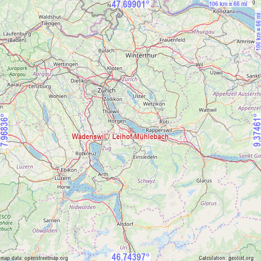
47° 13' 25.104" North, 8° 40' 17.364" East
| Map corner | latitude | longitude |
|---|---|---|
| Upper-left | 47.69901°, | 7.96836° |
| Center: | 47.22364°, | 8.67149° |
| Lower-right: | 46.74397°, | 9.37461° |
| Map W x H: | 106.2×106.2 km | = 66×66mi |
| max Lat: | 47.76737° ⇑50.8% North |
| Wädenswil / Leihof-Mühlebach: | 47.22364° |
| min Lat: | ⇓49.2% South 45.83203° |
| min Long | Wädenswil / Le | max Long |
| 5.97153° | 8.67149° | 10.44624° |
| W 71.8%⇐ | ⇒28.2% E |
Elevation
Elevation of Wädenswil / Leihof-Mühlebach is 481 m = 1578 ft, and this is 77.2 m = 253 ft below average elevation for this country.
| Max E: |
1845 m = 6053 ft | 48.6% |
| Avg. | 558.2 m = 1831 ft | |
| Wädenswil / Leihof-Mühlebach | 481 m = 1578 ft | |
Min E: |
197 m = 646 ft | 51.4% |
See also: Switzerland elevation on elevation.city.
Geographical zone
Wädenswil / Leihof-Mühlebach is located in North temperate zone (between Tropic of Cancer and the Arctic Circle). Distance of this North polar circle is 2150.4 km =1336.2 mi to North.| Distance of | km | miles | from Wädenswil / Leihof-Mühlebach |
|---|---|---|---|
| North Pole | 4756.3 | 2955.4 | to North |
| Arctic Circle | 2150.4 | 1336.2 | to North |
| Tropic Cancer | 2644.9 | 1643.5 | to South |
| Equator | 5250.8 | 3262.7 | to South |


Nearby cities:
15 places around Wädenswil / Leihof-Mühlebach: (largest is in red/bold)
• Au
2.9 km =1.8 mi,  314°
314°
• Au / Mittel-Dorf
2.9 km =1.8 mi,  318°
318°
• Au / Ober-Ort/Gwad
2.1 km =1.3 mi,  328°
328°
• Männedorf / Ausserfeld
3.6 km =2.2 mi,  45°
45°
• Richterswil
2.7 km =1.7 mi,  135°
135°
• Richterswil / Burghalde
2.2 km =1.4 mi, 135°
• Richterswil / Dorfkern
3.2 km =2 mi,  125°
125°
• Richterswil / Richterswil (Dorfkern)
3.4 km =2.1 mi, 131°
• Wädenswil
0.4 km =0.2 mi, 329°
• Wädenswil / Boller-Giessen
1 km =0.6 mi,  106°
106°
• Wädenswil / Büelen
1.3 km =0.8 mi, 332°
• Wädenswil / Dorf (Wädenswil)
0.6 km =0.4 mi,  4°
4°
• Wädenswil / Eichweid
0.6 km =0.4 mi,  159°
159°
• Wädenswil / Hangenmoos
1.8 km =1.1 mi, 307°
• Wädenswil / Untermosen-Fuhr
0.8 km =0.5 mi, 305°
Sources, notices
• [Note1] Compared only with cities in Switzerland existing in our database
• [Src1] Map data: © OpenStreetMap contributors (CC-BY-SA)
• [Src2] Other city data from geonames.org with taken over terms of usage.
• [Src3] Geographical zone / Annual Mean Temperature by Robert A. Rohde @ Wikipedia
