Obermeilen geodata
Obermeilen (Zurich) is a populated place; located in Switzerland in Europe/Zurich (GMT+2) time zone. With population of 2,871 people, there are 613 cities with bigger population in this country. Compared to other cities in Switzerland, 53.6% of cities are located further ↓South; 70.7% of cities are located further ←West and 81.2% of cities have higher elevation than Obermeilen. Note1


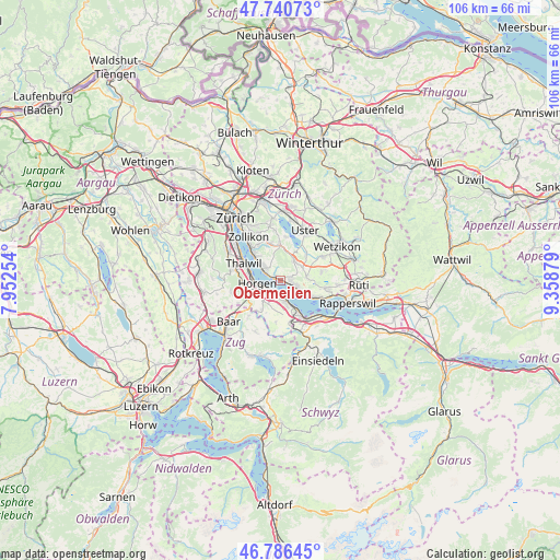
Obermeilen GPS coordinates[2]
47° 15' 56.664" North, 8° 39' 20.412" East
| Map corner | latitude | longitude |
|---|---|---|
| Upper-left | 47.74073°, | 7.95254° |
| Center: | 47.26574°, | 8.65567° |
| Lower-right: | 46.78645°, | 9.35879° |
| Map W x H: | 106.1×106.1 km | = 65.9×65.9mi |
| max Lat: | 47.76737° ⇑46.4% North |
| Obermeilen: | 47.26574° |
| min Lat: | ⇓53.6% South 45.83203° |
| min Long | Obermeilen | max Long |
| 5.97153° | 8.65567° | 10.44624° |
| W 70.7%⇐ | ⇒29.3% E |
Elevation
Elevation of Obermeilen is 419 m = 1375 ft, and this is 139.2 m = 457 ft below average elevation for this country.
| Max E: |
1845 m = 6053 ft | 81.2% |
| Avg. | 558.2 m = 1831 ft | |
| Obermeilen | 419 m = 1375 ft | |
Min E: |
197 m = 646 ft | 18.8% |
See also: Switzerland elevation on elevation.city.
Geographical zone
Obermeilen is located in North temperate zone (between Tropic of Cancer and the Arctic Circle). Distance of this North polar circle is 2145.7 km =1333.3 mi to North.| Distance of | km | miles | from Obermeilen |
|---|---|---|---|
| North Pole | 4751.6 | 2952.5 | to North |
| Arctic Circle | 2145.7 | 1333.3 | to North |
| Tropic Cancer | 2649.5 | 1646.3 | to South |
| Equator | 5255.5 | 3265.6 | to South |


Nearby cities:
15 places around Obermeilen: (largest is in red/bold)
• Au
2.8 km =1.7 mi,  198°
198°
• Au / Mittel-Dorf
2.6 km =1.6 mi, 196°
• Au / Ober-Ort/Gwad
2.9 km =1.8 mi,  177°
177°
• Au / Unter-Dorf
2.7 km =1.7 mi,  220°
220°
• Feldmeilen
2.9 km =1.8 mi,  299°
299°
• Horgen / Käpfnach
3.4 km =2.1 mi,  248°
248°
• Meilen
1 km =0.6 mi,  315°
315°
• Meilen / Halten
0.5 km =0.3 mi,  6°
6°
• Männedorf
3.4 km =2.1 mi,  106°
106°
• Männedorf / Dorfkern
2.9 km =1.8 mi, 111°
• Uetikon
1.8 km =1.1 mi,  94°
94°
• Uetikon / Chlidorf
2.1 km =1.3 mi, 94°
• Uetikon / Grossdorf
1.7 km =1.1 mi, 86°
• Wädenswil / Büelen
3.6 km =2.2 mi,  170°
170°
• Wädenswil / Hangenmoos
3.6 km =2.2 mi, 183°
Sources, notices
• [Note1] Compared only with cities in Switzerland existing in our database
• [Src1] Map data: © OpenStreetMap contributors (CC-BY-SA)
• [Src2] Other city data from geonames.org with taken over terms of usage.
• [Src3] Geographical zone / Annual Mean Temperature by Robert A. Rohde @ Wikipedia
