Rietgrabenhang geodata
Rietgrabenhang (Zurich) is a populated place; located in Switzerland in Europe/Zurich (GMT+2) time zone. With population of 761 people, there are 1520 cities with bigger population in this country. Compared to other cities in Switzerland, 78.7% of cities are located further ↓South; 63.7% of cities are located further ←West and 69.1% of cities have higher elevation than Rietgrabenhang. Note1


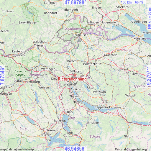
Rietgrabenhang GPS coordinates[2]
47° 25' 27.912" North, 8° 34' 35.688" East
| Map corner | latitude | longitude |
|---|---|---|
| Upper-left | 47.89798°, | 7.87346° |
| Center: | 47.42442°, | 8.57658° |
| Lower-right: | 46.94656°, | 9.27971° |
| Map W x H: | 105.8×105.8 km | = 65.7×65.7mi |
| max Lat: | 47.76737° ⇑21.3% North |
| Rietgrabenhang: | 47.42442° |
| min Lat: | ⇓78.7% South 45.83203° |
| min Long | Rietgrabenhang | max Long |
| 5.97153° | 8.57658° | 10.44624° |
| W 63.7%⇐ | ⇒36.3% E |
Elevation
Elevation of Rietgrabenhang is 440 m = 1444 ft, and this is 118.2 m = 388 ft below average elevation for this country.
| Max E: |
1845 m = 6053 ft | 69.1% |
| Avg. | 558.2 m = 1831 ft | |
| Rietgrabenhang | 440 m = 1444 ft | |
Min E: |
197 m = 646 ft | 30.9% |
See also: Switzerland elevation on elevation.city.
Geographical zone
Rietgrabenhang is located in North temperate zone (between Tropic of Cancer and the Arctic Circle). Distance of this North polar circle is 2128.1 km =1322.3 mi to North.| Distance of | km | miles | from Rietgrabenhang |
|---|---|---|---|
| North Pole | 4734 | 2941.6 | to North |
| Arctic Circle | 2128.1 | 1322.3 | to North |
| Tropic Cancer | 2667.2 | 1657.3 | to South |
| Equator | 5273.1 | 3276.6 | to South |


Nearby cities:
15 places around Rietgrabenhang: (largest is in red/bold)
• Glattbrugg
1.3 km =0.8 mi,  306°
306°
• Glattbrugg / Rohr/Platten-Balsberg
1.6 km =1 mi,  331°
331°
• Glattbrugg / Wydacker/Bettacker/Lättenwiesen
0.9 km =0.6 mi,  304°
304°
• Glattbrugg / Zentrum Müllacker
1.2 km =0.7 mi, 332°
• Grossacker/Opfikon
0.3 km =0.2 mi,  31°
31°
• Kloten / Balsberg
2 km =1.2 mi,  356°
356°
• Kloten / Bramen
2.1 km =1.3 mi,  5°
5°
• Opfikon
0.8 km =0.5 mi, 356°
• Wallisellen
1.8 km =1.1 mi,  124°
124°
• Wallisellen / Rieden
1.9 km =1.2 mi,  113°
113°
• Wallisellen / Wallisellen-Ost
1.9 km =1.2 mi,  125°
125°
• Wallisellen / Wallisellen-West
0.9 km =0.6 mi, 130°
• Zürich (Kreis 12) / Auzelg
1.1 km =0.7 mi,  205°
205°
• Zürich (Kreis 12) / Saatlen
1.7 km =1.1 mi, 211°
• Zürich (Kreis 12) / Schwamendingen-Mitte
2 km =1.2 mi,  188°
188°
Sources, notices
• [Note1] Compared only with cities in Switzerland existing in our database
• [Src1] Map data: © OpenStreetMap contributors (CC-BY-SA)
• [Src2] Other city data from geonames.org with taken over terms of usage.
• [Src3] Geographical zone / Annual Mean Temperature by Robert A. Rohde @ Wikipedia
