Glattbrugg / Wydacker/Bettacker/Lättenwiesen geodata
Glattbrugg / Wydacker/Bettacker/Lättenwiesen (Zurich) is a section of populated place; located in Switzerland in Europe/Zurich (GMT+2) time zone. With population of 1,551 people, there are 1010 cities with bigger population in this country. Compared to other cities in Switzerland, 79.3% of cities are located further ↓South; 62.9% of cities are located further ←West and 73.6% of cities have higher elevation than Glattbrugg / Wydacker/Bettacker/Lättenwiesen. Note1
Current local time in Glattbrugg / Wydacker/Bettacker/Lättenwiesen:
07:36 AM, SaturdayDifference from your time zone: hours


Glattbrugg / Wydacker/Bettacker/Lättenwiesen GPS coordinates[2]
47° 25' 44.688" North, 8° 33' 59.652" East
| Map corner | latitude | longitude |
|---|---|---|
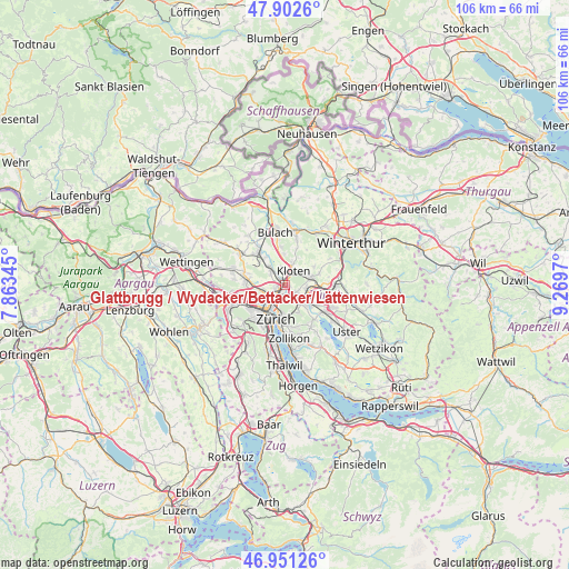
| Upper-left | 47.9026°, | 7.86345° |
| Center: | 47.42908°, | 8.56657° |
| Lower-right: | 46.95126°, | 9.2697° |
| Map W x H: | 105.8×105.8 km | = 65.7×65.7mi |
| max Lat: | 47.76737° ⇑20.7% North |
| Glattbrugg / Wydacker/Bettacker/Lättenwiesen: | 47.42908° |
| min Lat: | ⇓79.3% South 45.83203° |
| min Long | Glattbrugg / Wy | max Long |
| 5.97153° | 8.56657° | 10.44624° |
| W 62.9%⇐ | ⇒37.1% E |
Elevation
Elevation of Glattbrugg / Wydacker/Bettacker/Lättenwiesen is 434 m = 1424 ft, and this is 124.2 m = 407 ft below average elevation for this country.
| Max E: |
1845 m = 6053 ft | 73.6% |
| Avg. | 558.2 m = 1831 ft | |
| Glattbrugg / Wydacker/Bettacker/Lättenwiesen | 434 m = 1424 ft | |
Min E: |
197 m = 646 ft | 26.4% |
See also: Switzerland elevation on elevation.city.
Geographical zone
Glattbrugg / Wydacker/Bettacker/Lättenwiesen is located in North temperate zone (between Tropic of Cancer and the Arctic Circle). Distance of this North polar circle is 2127.6 km =1322 mi to North.| Distance of | km | miles | from Glattbrugg / Wydacker/Bettacker/Lättenwiesen |
|---|---|---|---|
| North Pole | 4733.4 | 2941.2 | to North |
| Arctic Circle | 2127.6 | 1322 | to North |
| Tropic Cancer | 2667.7 | 1657.6 | to South |
| Equator | 5273.6 | 3276.9 | to South |


Nearby cities:
15 places around Glattbrugg / Wydacker/Bettacker/Lättenwiesen: (largest is in red/bold)
• Glattbrugg
0.4 km =0.2 mi,  310°
310°
• Glattbrugg / Rohr/Platten-Balsberg
0.9 km =0.6 mi,  359°
359°
• Glattbrugg / Zentrum Müllacker
0.6 km =0.4 mi,  18°
18°
• Grossacker/Opfikon
1 km =0.6 mi,  104°
104°
• Kloten / Balsberg
1.6 km =1 mi, 23°
• Kloten / Bramen
1.8 km =1.1 mi,  31°
31°
• Kloten / Holberg
2.1 km =1.3 mi, 21°
• Kloten / Rütlen
2.6 km =1.6 mi,  38°
38°
• Kloten / Spitz
2.3 km =1.4 mi, 42°
• Opfikon
0.8 km =0.5 mi,  67°
67°
• Rietgrabenhang
0.9 km =0.6 mi,  124°
124°
• Wallisellen / Wallisellen-West
1.8 km =1.1 mi,  127°
127°
• Zürich (Kreis 11) / Seebach
1.6 km =1 mi,  240°
240°
• Zürich (Kreis 12) / Auzelg
1.6 km =1 mi,  170°
170°
• Zürich (Kreis 12) / Saatlen
2 km =1.2 mi,  183°
183°
Sources, notices
• [Note1] Compared only with cities in Switzerland existing in our database
• [Src1] Map data: © OpenStreetMap contributors (CC-BY-SA)
• [Src2] Other city data from geonames.org with taken over terms of usage.
• [Src3] Geographical zone / Annual Mean Temperature by Robert A. Rohde @ Wikipedia
