Glattbrugg geodata
Glattbrugg (Zurich) is a section of populated place; located in Switzerland in Europe/Zurich (GMT+2) time zone. With population of 2,642 people, there are 666 cities with bigger population in this country. Compared to other cities in Switzerland, 79.8% of cities are located further ↓South; 62.5% of cities are located further ←West and 75% of cities have higher elevation than Glattbrugg. Note1


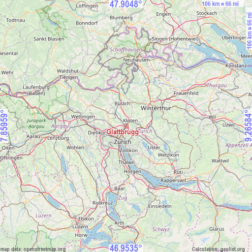
Glattbrugg GPS coordinates[2]
47° 25' 52.68" North, 8° 33' 45.792" East
| Map corner | latitude | longitude |
|---|---|---|
| Upper-left | 47.9048°, | 7.85959° |
| Center: | 47.4313°, | 8.56272° |
| Lower-right: | 46.9535°, | 9.26584° |
| Map W x H: | 105.8×105.8 km | = 65.7×65.7mi |
| max Lat: | 47.76737° ⇑20.2% North |
| Glattbrugg: | 47.4313° |
| min Lat: | ⇓79.8% South 45.83203° |
| min Long | Glattbrugg | max Long |
| 5.97153° | 8.56272° | 10.44624° |
| W 62.5%⇐ | ⇒37.5% E |
Elevation
Elevation of Glattbrugg is 431 m = 1414 ft, and this is 127.2 m = 417 ft below average elevation for this country.
| Max E: |
1845 m = 6053 ft | 75% |
| Avg. | 558.2 m = 1831 ft | |
| Glattbrugg | 431 m = 1414 ft | |
Min E: |
197 m = 646 ft | 25% |
See also: Switzerland elevation on elevation.city.
Geographical zone
Glattbrugg is located in North temperate zone (between Tropic of Cancer and the Arctic Circle). Distance of this North polar circle is 2127.3 km =1321.8 mi to North.| Distance of | km | miles | from Glattbrugg |
|---|---|---|---|
| North Pole | 4733.2 | 2941.1 | to North |
| Arctic Circle | 2127.3 | 1321.8 | to North |
| Tropic Cancer | 2667.9 | 1657.8 | to South |
| Equator | 5273.9 | 3277 | to South |


Nearby cities:
15 places around Glattbrugg: (largest is in red/bold)
• Glattbrugg / Rohr/Platten-Balsberg
0.7 km =0.4 mi,  22°
22°
• Glattbrugg / Wydacker/Bettacker/Lättenwiesen
0.4 km =0.2 mi,  130°
130°
• Glattbrugg / Zentrum Müllacker
0.6 km =0.4 mi,  55°
55°
• Grossacker/Opfikon
1.3 km =0.8 mi,  111°
111°
• Kloten / Balsberg
1.5 km =0.9 mi,  36°
36°
• Kloten / Bramen
1.8 km =1.1 mi, 42°
• Kloten / Holberg
2 km =1.2 mi,  31°
31°
• Kloten / Rütlen
2.6 km =1.6 mi,  47°
47°
• Kloten / Spitz
2.4 km =1.5 mi, 51°
• Opfikon
1 km =0.6 mi,  87°
87°
• Rietgrabenhang
1.3 km =0.8 mi, 126°
• Wallisellen / Wallisellen-West
2.2 km =1.4 mi, 128°
• Zürich (Kreis 11) / Seebach
1.5 km =0.9 mi,  226°
226°
• Zürich (Kreis 12) / Auzelg
1.9 km =1.2 mi,  162°
162°
• Zürich (Kreis 12) / Saatlen
2.2 km =1.4 mi,  175°
175°
Sources, notices
• [Note1] Compared only with cities in Switzerland existing in our database
• [Src1] Map data: © OpenStreetMap contributors (CC-BY-SA)
• [Src2] Other city data from geonames.org with taken over terms of usage.
• [Src3] Geographical zone / Annual Mean Temperature by Robert A. Rohde @ Wikipedia
