Rümlang / Huebacher geodata
Rümlang / Huebacher (Zurich) is a section of populated place; located in Switzerland in Europe/Zurich (GMT+2) time zone. With population of 712 people, there are 1580 cities with bigger population in this country. Compared to other cities in Switzerland, 81.5% of cities are located further ↓South; 59.2% of cities are located further ←West and 53.7% of cities have higher elevation than Rümlang / Huebacher. Note1


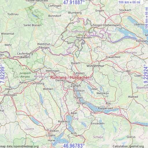
Rümlang / Huebacher GPS coordinates[2]
47° 26' 43.8" North, 8° 31' 34.032" East
| Map corner | latitude | longitude |
|---|---|---|
| Upper-left | 47.91887°, | 7.82299° |
| Center: | 47.4455°, | 8.52612° |
| Lower-right: | 46.96783°, | 9.22924° |
| Map W x H: | 105.7×105.7 km | = 65.7×65.7mi |
| max Lat: | 47.76737° ⇑18.5% North |
| Rümlang / Huebacher: | 47.4455° |
| min Lat: | ⇓81.5% South 45.83203° |
| min Long | Rümlang / Hueb | max Long |
| 5.97153° | 8.52612° | 10.44624° |
| W 59.2%⇐ | ⇒40.8% E |
Elevation
Elevation of Rümlang / Huebacher is 470 m = 1542 ft, and this is 88.2 m = 289 ft below average elevation for this country.
| Max E: |
1845 m = 6053 ft | 53.7% |
| Avg. | 558.2 m = 1831 ft | |
| Rümlang / Huebacher | 470 m = 1542 ft | |
Min E: |
197 m = 646 ft | 46.3% |
See also: Switzerland elevation on elevation.city.
Geographical zone
Rümlang / Huebacher is located in North temperate zone (between Tropic of Cancer and the Arctic Circle). Distance of this North polar circle is 2125.7 km =1320.8 mi to North.| Distance of | km | miles | from Rümlang / Huebacher |
|---|---|---|---|
| North Pole | 4731.6 | 2940.1 | to North |
| Arctic Circle | 2125.7 | 1320.8 | to North |
| Tropic Cancer | 2669.5 | 1658.7 | to South |
| Equator | 5275.4 | 3278 | to South |


Nearby cities:
15 places around Rümlang / Huebacher: (largest is in red/bold)
• Glattbrugg
3.2 km =2 mi,  119°
119°
• Glattbrugg / Rohr/Platten-Balsberg
3.2 km =2 mi,  106°
106°
• Glattbrugg / Wydacker/Bettacker/Lättenwiesen
3.5 km =2.2 mi, 120°
• Glattbrugg / Zentrum Müllacker
3.5 km =2.2 mi, 111°
• Oberglatt
3.4 km =2.1 mi,  350°
350°
• Oberglatt / Bahnhofquartier
3 km =1.9 mi,  340°
340°
• Oberglatt / Oberglatt (Dorfkern)
3.4 km =2.1 mi, 351°
• Oberhasli / Birch
3.3 km =2.1 mi,  324°
324°
• Rümlang
0.6 km =0.4 mi,  27°
27°
• Rümlang / Rümlang (Dorfkern)
0.6 km =0.4 mi,  48°
48°
• Rümlang / Säntisstrasse-Aegler
0.8 km =0.5 mi,  0°
0°
• Zürich (Kreis 11)
2.5 km =1.6 mi,  187°
187°
• Zürich (Kreis 11) / Affoltern
3.2 km =2 mi,  198°
198°
• Zürich (Kreis 11) / Schwandenholz
2.3 km =1.4 mi, 189°
• Zürich (Kreis 11) / Seebach
3.1 km =1.9 mi,  148°
148°
Sources, notices
• [Note1] Compared only with cities in Switzerland existing in our database
• [Src1] Map data: © OpenStreetMap contributors (CC-BY-SA)
• [Src2] Other city data from geonames.org with taken over terms of usage.
• [Src3] Geographical zone / Annual Mean Temperature by Robert A. Rohde @ Wikipedia
