Männedorf / Ausserfeld geodata
Männedorf / Ausserfeld (Zurich) is a section of populated place; located in Switzerland in Europe/Zurich (GMT+2) time zone. With population of 1,175 people, there are 1218 cities with bigger population in this country. Compared to other cities in Switzerland, 51.4% of cities are located further ↓South; 74.8% of cities are located further ←West and 85.3% of cities have higher elevation than Männedorf / Ausserfeld. Note1
Current local time in Männedorf / Ausserfeld:
07:35 AM, SaturdayDifference from your time zone: hours


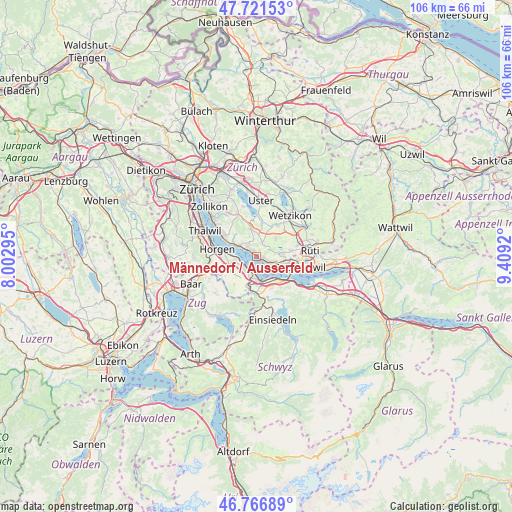
Männedorf / Ausserfeld GPS coordinates[2]
47° 14' 46.896" North, 8° 42' 21.888" East
| Map corner | latitude | longitude |
|---|---|---|
| Upper-left | 47.72153°, | 8.00295° |
| Center: | 47.24636°, | 8.70608° |
| Lower-right: | 46.76689°, | 9.4092° |
| Map W x H: | 106.1×106.1 km | = 65.9×65.9mi |
| max Lat: | 47.76737° ⇑48.6% North |
| Männedorf / Ausserfeld: | 47.24636° |
| min Lat: | ⇓51.4% South 45.83203° |
| min Long | Männedorf / Au | max Long |
| 5.97153° | 8.70608° | 10.44624° |
| W 74.8%⇐ | ⇒25.2% E |
Elevation
Elevation of Männedorf / Ausserfeld is 409 m = 1342 ft, and this is 149.2 m = 490 ft below average elevation for this country.
| Max E: |
1845 m = 6053 ft | 85.3% |
| Avg. | 558.2 m = 1831 ft | |
| Männedorf / Ausserfeld | 409 m = 1342 ft | |
Min E: |
197 m = 646 ft | 14.7% |
See also: Switzerland elevation on elevation.city.
Geographical zone
Männedorf / Ausserfeld is located in North temperate zone (between Tropic of Cancer and the Arctic Circle). Distance of this North polar circle is 2147.9 km =1334.6 mi to North.| Distance of | km | miles | from Männedorf / Ausserfeld |
|---|---|---|---|
| North Pole | 4753.8 | 2953.9 | to North |
| Arctic Circle | 2147.9 | 1334.6 | to North |
| Tropic Cancer | 2647.4 | 1645 | to South |
| Equator | 5253.3 | 3264.2 | to South |


Nearby cities:
15 places around Männedorf / Ausserfeld: (largest is in red/bold)
• Dorf
2.4 km =1.5 mi,  110°
110°
• Kehlhof
2.8 km =1.7 mi,  117°
117°
• Männedorf
1.3 km =0.8 mi,  335°
335°
• Männedorf / Dorfkern
1.5 km =0.9 mi,  314°
314°
• Oetwil
2.9 km =1.8 mi,  21°
21°
• Oetwil / Vogelsang
2.7 km =1.7 mi,  36°
36°
• Oetwil / Zelgliacker
3.2 km =2 mi, 19°
• Stäfa
1.4 km =0.9 mi, 107°
• Uetikon
2.9 km =1.8 mi, 314°
• Uetikon / Chlidorf
2.6 km =1.6 mi,  319°
319°
• Uetikon / Grossdorf
3.1 km =1.9 mi, 316°
• Wädenswil / Boller-Giessen
3.3 km =2.1 mi,  210°
210°
• Wädenswil / Büelen
3.5 km =2.2 mi,  246°
246°
• Wädenswil / Dorf (Wädenswil)
3.2 km =2 mi,  233°
233°
• Wädenswil / Leihof-Mühlebach
3.6 km =2.2 mi, 225°
Sources, notices
• [Note1] Compared only with cities in Switzerland existing in our database
• [Src1] Map data: © OpenStreetMap contributors (CC-BY-SA)
• [Src2] Other city data from geonames.org with taken over terms of usage.
• [Src3] Geographical zone / Annual Mean Temperature by Robert A. Rohde @ Wikipedia
