Effretikon / Moosburg geodata
Effretikon / Moosburg (Zurich) is a section of populated place; located in Switzerland in Europe/Zurich (GMT+2) time zone. With population of 781 people, there are 1506 cities with bigger population in this country. Compared to other cities in Switzerland, 77.9% of cities are located further ↓South; 73.7% of cities are located further ←West and 59.1% of cities have lower elevation than Effretikon / Moosburg. Note1
Current local time in Effretikon / Moosburg:
08:52 AM, SaturdayDifference from your time zone: hours


Effretikon / Moosburg GPS coordinates[2]
47° 25' 17.112" North, 8° 41' 29.436" East
| Map corner | latitude | longitude |
|---|---|---|
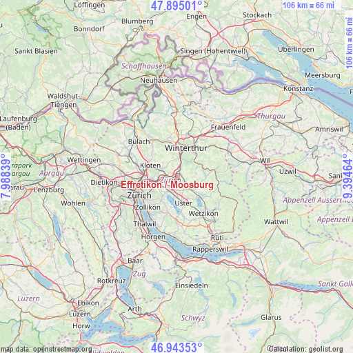
| Upper-left | 47.89501°, | 7.98839° |
| Center: | 47.42142°, | 8.69151° |
| Lower-right: | 46.94353°, | 9.39464° |
| Map W x H: | 105.8×105.8 km | = 65.7×65.7mi |
| max Lat: | 47.76737° ⇑22.1% North |
| Effretikon / Moosburg: | 47.42142° |
| min Lat: | ⇓77.9% South 45.83203° |
| min Long | Effretikon / Mo | max Long |
| 5.97153° | 8.69151° | 10.44624° |
| W 73.7%⇐ | ⇒26.3% E |
Elevation
Elevation of Effretikon / Moosburg is 514 m = 1686 ft, and this is 44.2 m = 145 ft below average elevation for this country.
| Max E: |
1845 m = 6053 ft | 40.9% |
| Avg. | 558.2 m = 1831 ft | |
| Effretikon / Moosburg | 514 m = 1686 ft | |
Min E: |
197 m = 646 ft | 59.1% |
See also: Switzerland elevation on elevation.city.
Geographical zone
Effretikon / Moosburg is located in North temperate zone (between Tropic of Cancer and the Arctic Circle). Distance of this North polar circle is 2128.4 km =1322.5 mi to North.| Distance of | km | miles | from Effretikon / Moosburg |
|---|---|---|---|
| North Pole | 4734.3 | 2941.8 | to North |
| Arctic Circle | 2128.4 | 1322.5 | to North |
| Tropic Cancer | 2666.8 | 1657.1 | to South |
| Equator | 5272.8 | 3276.4 | to South |


Nearby cities:
15 places around Effretikon / Moosburg: (largest is in red/bold)
• Effretikon
0.5 km =0.3 mi,  354°
354°
• Effretikon / Brandenriet / Vogelsang
0.4 km =0.2 mi,  267°
267°
• Effretikon / Rappenhalde-Bannhalde
0.5 km =0.3 mi,  54°
54°
• Effretikon / Rikon
1.1 km =0.7 mi,  339°
339°
• Effretikon / Watt
0.9 km =0.6 mi,  34°
34°
• Grafstal
2.5 km =1.6 mi,  13°
13°
• Hegnau
3.6 km =2.2 mi,  206°
206°
• Hegnau / Sunnebüel-Eich
3.4 km =2.1 mi,  196°
196°
• Illnau
2.5 km =1.6 mi,  116°
116°
• Illnau / Ober-Illnau
2 km =1.2 mi,  111°
111°
• Illnau / Unter-Illnau
3 km =1.9 mi, 120°
• Kindhausen / Kindhausen (Dorf)
1.8 km =1.1 mi, 201°
• Lindau
2.8 km =1.7 mi,  330°
330°
• Tagelswangen
1.7 km =1.1 mi,  306°
306°
• Volketswil / Volketswil (Dorf)
3.5 km =2.2 mi,  180°
180°
Sources, notices
• [Note1] Compared only with cities in Switzerland existing in our database
• [Src1] Map data: © OpenStreetMap contributors (CC-BY-SA)
• [Src2] Other city data from geonames.org with taken over terms of usage.
• [Src3] Geographical zone / Annual Mean Temperature by Robert A. Rohde @ Wikipedia
