Illnau / Unter-Illnau geodata
Illnau / Unter-Illnau (Zurich) is a section of populated place; located in Switzerland in Europe/Zurich (GMT+1) time zone. With population of 2,011 people, there are 829 cities with bigger population in this country. Compared to other cities in Switzerland, 75.4% of cities are located further ↓South; 76.7% of cities are located further ←West and 57.5% of cities have lower elevation than Illnau / Unter-Illnau. Note1


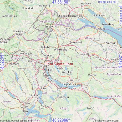
Illnau / Unter-Illnau GPS coordinates[2]
47° 24' 28.332" North, 8° 43' 33.852" East
| Map corner | latitude | longitude |
|---|---|---|
| Upper-left | 47.88158°, | 8.02295° |
| Center: | 47.40787°, | 8.72607° |
| Lower-right: | 46.92986°, | 9.4292° |
| Map W x H: | 105.8×105.8 km | = 65.7×65.7mi |
| max Lat: | 47.76737° ⇑24.6% North |
| Illnau / Unter-Illnau: | 47.40787° |
| min Lat: | ⇓75.4% South 45.83203° |
| min Long | Illnau / Unter- | max Long |
| 5.97153° | 8.72607° | 10.44624° |
| W 76.7%⇐ | ⇒23.3% E |
Elevation
Elevation of Illnau / Unter-Illnau is 506 m = 1660 ft, and this is 52.2 m = 171 ft below average elevation for this country.
| Max E: |
1845 m = 6053 ft | 42.5% |
| Avg. | 558.2 m = 1831 ft | |
| Illnau / Unter-Illnau | 506 m = 1660 ft | |
Min E: |
197 m = 646 ft | 57.5% |
See also: Switzerland elevation on elevation.city.
Geographical zone
Illnau / Unter-Illnau is located in North temperate zone (between Tropic of Cancer and the Arctic Circle). Distance of this North polar circle is 2129.9 km =1323.5 mi to North.| Distance of | km | miles | from Illnau / Unter-Illnau |
|---|---|---|---|
| North Pole | 4735.8 | 2942.7 | to North |
| Arctic Circle | 2129.9 | 1323.5 | to North |
| Tropic Cancer | 2665.3 | 1656.1 | to South |
| Equator | 5271.3 | 3275.4 | to South |


Nearby cities:
15 places around Illnau / Unter-Illnau: (largest is in red/bold)
• Effretikon
3.3 km =2.1 mi,  306°
306°
• Effretikon / Brandenriet / Vogelsang
3.4 km =2.1 mi,  295°
295°
• Effretikon / Moosburg
3 km =1.9 mi, 300°
• Effretikon / Rappenhalde-Bannhalde
2.8 km =1.7 mi, 308°
• Effretikon / Rikon
3.9 km =2.4 mi, 310°
• Effretikon / Watt
3.1 km =1.9 mi,  316°
316°
• Fehraltorf
2.9 km =1.8 mi,  139°
139°
• Gutenswil
2.7 km =1.7 mi,  193°
193°
• Hegnau / Sunnebüel-Eich
3.9 km =2.4 mi,  244°
244°
• Illnau
0.5 km =0.3 mi, 316°
• Illnau / Ober-Illnau
1.1 km =0.7 mi, 316°
• Kindhausen / Kindhausen (Dorf)
3.2 km =2 mi,  267°
267°
• Russikon
3.9 km =2.4 mi,  108°
108°
• Volketswil / Volketswil (Dorf)
3.3 km =2.1 mi,  233°
233°
• Weisslingen
4 km =2.5 mi,  51°
51°
Sources, notices
• [Note1] Compared only with cities in Switzerland existing in our database
• [Src1] Map data: © OpenStreetMap contributors (CC-BY-SA)
• [Src2] Other city data from geonames.org with taken over terms of usage.
• [Src3] Geographical zone / Annual Mean Temperature by Robert A. Rohde @ Wikipedia
