Effretikon / Rappenhalde-Bannhalde geodata
Effretikon / Rappenhalde-Bannhalde (Zurich) is a section of populated place; located in Switzerland in Europe/Zurich (GMT+2) time zone. With population of 1,758 people, there are 921 cities with bigger population in this country. Compared to other cities in Switzerland, 78.5% of cities are located further ↓South; 73.9% of cities are located further ←West and 60% of cities have lower elevation than Effretikon / Rappenhalde-Bannhalde. Note1
Current local time in Effretikon / Rappenhalde-Bannhalde:
08:52 AM, SaturdayDifference from your time zone: hours


Effretikon / Rappenhalde-Bannhalde GPS coordinates[2]
47° 25' 25.968" North, 8° 41' 47.508" East
| Map corner | latitude | longitude |
|---|---|---|
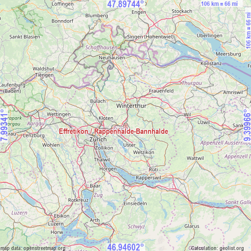
| Upper-left | 47.89744°, | 7.99341° |
| Center: | 47.42388°, | 8.69653° |
| Lower-right: | 46.94602°, | 9.39966° |
| Map W x H: | 105.8×105.8 km | = 65.7×65.7mi |
| max Lat: | 47.76737° ⇑21.5% North |
| Effretikon / Rappenhalde-Bannhalde: | 47.42388° |
| min Lat: | ⇓78.5% South 45.83203° |
| min Long | Effretikon / Ra | max Long |
| 5.97153° | 8.69653° | 10.44624° |
| W 73.9%⇐ | ⇒26.1% E |
Elevation
Elevation of Effretikon / Rappenhalde-Bannhalde is 519 m = 1703 ft, and this is 39.2 m = 129 ft below average elevation for this country.
| Max E: |
1845 m = 6053 ft | 40% |
| Avg. | 558.2 m = 1831 ft | |
| Effretikon / Rappenhalde-Bannhalde | 519 m = 1703 ft | |
Min E: |
197 m = 646 ft | 60% |
See also: Switzerland elevation on elevation.city.
Geographical zone
Effretikon / Rappenhalde-Bannhalde is located in North temperate zone (between Tropic of Cancer and the Arctic Circle). Distance of this North polar circle is 2128.1 km =1322.3 mi to North.| Distance of | km | miles | from Effretikon / Rappenhalde-Bannhalde |
|---|---|---|---|
| North Pole | 4734 | 2941.6 | to North |
| Arctic Circle | 2128.1 | 1322.3 | to North |
| Tropic Cancer | 2667.1 | 1657.3 | to South |
| Equator | 5273 | 3276.5 | to South |


Nearby cities:
15 places around Effretikon / Rappenhalde-Bannhalde: (largest is in red/bold)
• Effretikon
0.5 km =0.3 mi,  296°
296°
• Effretikon / Brandenriet / Vogelsang
0.9 km =0.6 mi,  250°
250°
• Effretikon / Moosburg
0.5 km =0.3 mi,  234°
234°
• Effretikon / Rikon
1.1 km =0.7 mi,  315°
315°
• Effretikon / Watt
0.5 km =0.3 mi,  15°
15°
• Grafstal
2.2 km =1.4 mi,  6°
6°
• Hegnau / Sunnebüel-Eich
3.7 km =2.3 mi,  200°
200°
• Illnau
2.3 km =1.4 mi,  126°
126°
• Illnau / Ober-Illnau
1.8 km =1.1 mi,  124°
124°
• Illnau / Unter-Illnau
2.8 km =1.7 mi, 128°
• Kindhausen / Kindhausen (Dorf)
2.2 km =1.4 mi,  207°
207°
• Lindau
2.7 km =1.7 mi, 320°
• Tagelswangen
1.9 km =1.2 mi,  293°
293°
• Volketswil / Volketswil (Dorf)
3.8 km =2.4 mi,  186°
186°
• Winterberg
3.6 km =2.2 mi,  357°
357°
Sources, notices
• [Note1] Compared only with cities in Switzerland existing in our database
• [Src1] Map data: © OpenStreetMap contributors (CC-BY-SA)
• [Src2] Other city data from geonames.org with taken over terms of usage.
• [Src3] Geographical zone / Annual Mean Temperature by Robert A. Rohde @ Wikipedia
