Greifensee / Pfisterhölzli geodata
Greifensee / Pfisterhölzli (Zurich) is a section of populated place; located in Switzerland in Europe/Zurich (GMT+2) time zone. With population of 1,135 people, there are 1240 cities with bigger population in this country. Compared to other cities in Switzerland, 66.7% of cities are located further ↓South; 73.4% of cities are located further ←West and 58.2% of cities have higher elevation than Greifensee / Pfisterhölzli. Note1
Current local time in Greifensee / Pfisterhölzli:
07:36 AM, SaturdayDifference from your time zone: hours


Greifensee / Pfisterhölzli GPS coordinates[2]
47° 21' 51.48" North, 8° 41' 23.244" East
| Map corner | latitude | longitude |
|---|---|---|
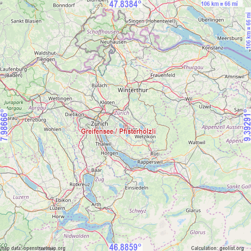
| Upper-left | 47.8384°, | 7.98666° |
| Center: | 47.3643°, | 8.68979° |
| Lower-right: | 46.8859°, | 9.39291° |
| Map W x H: | 105.9×105.9 km | = 65.8×65.8mi |
| max Lat: | 47.76737° ⇑33.3% North |
| Greifensee / Pfisterhölzli: | 47.3643° |
| min Lat: | ⇓66.7% South 45.83203° |
| min Long | Greifensee / Pf | max Long |
| 5.97153° | 8.68979° | 10.44624° |
| W 73.4%⇐ | ⇒26.6% E |
Elevation
Elevation of Greifensee / Pfisterhölzli is 458 m = 1503 ft, and this is 100.2 m = 329 ft below average elevation for this country.
| Max E: |
1845 m = 6053 ft | 58.2% |
| Avg. | 558.2 m = 1831 ft | |
| Greifensee / Pfisterhölzli | 458 m = 1503 ft | |
Min E: |
197 m = 646 ft | 41.8% |
See also: Switzerland elevation on elevation.city.
Geographical zone
Greifensee / Pfisterhölzli is located in North temperate zone (between Tropic of Cancer and the Arctic Circle). Distance of this North polar circle is 2134.8 km =1326.5 mi to North.| Distance of | km | miles | from Greifensee / Pfisterhölzli |
|---|---|---|---|
| North Pole | 4740.6 | 2945.7 | to North |
| Arctic Circle | 2134.8 | 1326.5 | to North |
| Tropic Cancer | 2660.5 | 1653.2 | to South |
| Equator | 5266.4 | 3272.4 | to South |


Nearby cities:
15 places around Greifensee / Pfisterhölzli: (largest is in red/bold)
• Greifensee
0.7 km =0.4 mi,  296°
296°
• Greifensee / Müllerwis / Seilerwis
0.9 km =0.6 mi,  317°
317°
• Greifensee / Ocht
1.4 km =0.9 mi, 317°
• Gutenswil
3 km =1.9 mi,  43°
43°
• Hegnau / Alt-Hegnau
2.9 km =1.8 mi,  337°
337°
• Hegnau / Im Zentrum
2.6 km =1.6 mi,  345°
345°
• Nänikon
0.6 km =0.4 mi, 353°
• Nänikon / Nänikon (Dorfkern)
0.8 km =0.5 mi,  15°
15°
• Schwerzenbach / Widacher
3.1 km =1.9 mi,  308°
308°
• Uster
3 km =1.9 mi,  129°
129°
• Uster / Gschwader
1.9 km =1.2 mi,  104°
104°
• Uster / Kirch-Uster
3 km =1.9 mi, 133°
• Uster / Nieder-Uster
2.1 km =1.3 mi,  155°
155°
• Volketswil / Volketswil (Dorf)
2.9 km =1.8 mi,  1°
1°
• Zimikon / Rütiwies
2.8 km =1.7 mi, 320°
Sources, notices
• [Note1] Compared only with cities in Switzerland existing in our database
• [Src1] Map data: © OpenStreetMap contributors (CC-BY-SA)
• [Src2] Other city data from geonames.org with taken over terms of usage.
• [Src3] Geographical zone / Annual Mean Temperature by Robert A. Rohde @ Wikipedia
